


Pâques, gouffre dun creux percé, grottes des Célérons.

florianlive
Gebruiker

Lengte
19,4 km

Max. hoogte
540 m

Positief hoogteverschil
432 m
Km-Effort
25 km

Min. hoogte
370 m

Negatief hoogteverschil
431 m
Boucle
Ja
Datum van aanmaak :
2016-03-09 00:00:00.0
Laatste wijziging :
2016-03-09 00:00:00.0
5h58
Moeilijkheid : Medium

Gratisgps-wandelapplicatie
 SityTrail
IGN / Geografische instituten
SityTrail Plus
De wereld gaat voor u open
Over ons
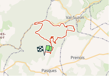
Tocht Stappen van 19,4 km beschikbaar op Bourgondië-Franche-Comté, Côte-d'Or, Pasques. Deze tocht wordt voorgesteld door florianlive.


Plaatsbepaling
Land:
France
Regio :
Bourgondië-Franche-Comté
Departement/Provincie :
Côte-d'Or
Gemeente :
Pasques
Locatie:
Unknown
Vertrek:(Dec)
Vertrek:(UTM)
640345 ; 5248865 (31T) N.
Opmerkingen