Tocht Stappen Fontainebleau - Fontainebleau: points de vue et rochers spectaculaires  - Photo

Fontainebleau: points de vue et rochers spectaculaires

 bduche
bduche

Gebruiker

© OpenStreetMap contributors
Lengte
Lengte
24 km
Max. hoogte
Max. hoogte
139 m
Positief hoogteverschil
392 m
Km-Effort
Km-Effort  
29 km
Min. hoogte
Min. hoogte
83 m
Negatief hoogteverschil
394 m
Boucle
Boucle
Ja
Datum van aanmaak :
2016-03-09 00:00:00.0
Laatste wijziging :
2016-03-09 00:00:00.0

(0 Bericht)

Stappen
Stappen
4h51
Moeilijkheid : Moeilijk

Scan deze QR-code om de tocht te openen in de SityTrail-applicatie

Gratisgps-wandelapplicatie

Logo SityTrail SityTrail

IGN / Geografische instituten

SityTrail uit de App Store downloaden SityTrail uit Google Play downloaden

Logo SityTrail SityTrail Plus

De wereld gaat voor u open

SityTrail uit de App Store downloaden SityTrail uit Google Play downloaden SityTrail op Huawei AppGallery downloaden

Over ons

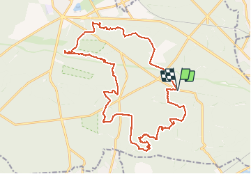
Tocht Stappen van 24 km beschikbaar op Île-de-France, Seine-et-Marne, Fontainebleau. Deze tocht wordt voorgesteld door bduche.

Beschrijving

Balade qui conduit du Rocher des Princes au Carrosse, puis à la grotte Béatrix et au magnifique rempart du Restant du Long Rocher. Poursuite par le point de vue de l'Inspecteur général, puis par le rocher de Bouligny et le Rocher  d'Avon. Très beau en hiver quand les sous-bois sont dégagés, ainsi que les points de vue.

Hoogteprofiel

Plaatsbepaling

Land:
France
Regio :
Île-de-France
Departement/Provincie :
Seine-et-Marne
Gemeente :
Fontainebleau
Locatie:
Unknown
Vertrek:(Dec)
Vertrek:(UTM)
481438 ; 5357749 (31U) N.


Sluiten
Mijn abonnementen