Tocht Stappen Savonnières-en-Perthois - 17/17a Vallées de l'Ornain et de la Saulx - Photo

17/17a Vallées de l'Ornain et de la Saulx

 cath310
cath310

Gebruiker

© OpenStreetMap contributors
Lengte
Lengte
26 km
Max. hoogte
Max. hoogte
298 m
Positief hoogteverschil
384 m
Km-Effort
Km-Effort  
31 km
Min. hoogte
Min. hoogte
161 m
Negatief hoogteverschil
375 m
Boucle
Boucle
Ja
Datum van aanmaak :
2016-04-11 00:00:00.0
Laatste wijziging :
2016-04-11 00:00:00.0

(2 Bericht)

Stappen
Stappen
6h45
Moeilijkheid : Medium

Scan deze QR-code om de tocht te openen in de SityTrail-applicatie

Gratisgps-wandelapplicatie

Logo SityTrail SityTrail

IGN / Geografische instituten

SityTrail uit de App Store downloaden SityTrail uit Google Play downloaden

Logo SityTrail SityTrail Plus

De wereld gaat voor u open

SityTrail uit de App Store downloaden SityTrail uit Google Play downloaden SityTrail op Huawei AppGallery downloaden

Over ons

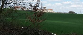
Tocht Stappen van 26 km beschikbaar op Grand Est, Meuse, Savonnières-en-Perthois. Deze tocht wordt voorgesteld door cath310.

Beschrijving

D/R : SAVONNIERES-EN-PERTHOIS
Place de l'église
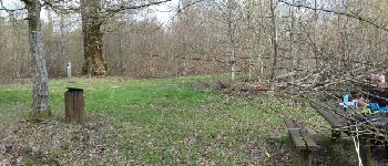
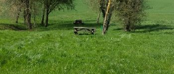
sur la route chêne PARIS-SAIGON avc coin pique-nique, abbaye de Jovilliers...
tbelle randonnée faite le 10/04/2016

Hoogteprofiel

Foto's

POI's

POI Juvigny-en-Perthois - Point 1 - Photo
cath310
JUVIGNY-EN-PERTHOIS 
POI Stainville - Point 3 - Photo
cath310
STAINVILLE 
POI Stainville - Point 4 - Photo
cath310
STAINVILLE 
POI Savonnières-en-Perthois - Point 5 - Photo
cath310
SAVONNIÈRES-EN-PERTHOIS 
POI Aulnois-en-Perthois - Point 7 - Photo
cath310
AULNOIS-EN-PERTHOIS 

Plaatsbepaling

Land:
France
Regio :
Grand Est
Departement/Provincie :
Meuse
Gemeente :
Savonnières-en-Perthois
Locatie:
Unknown
Vertrek:(Dec)
Vertrek:(UTM)
657064 ; 5385520 (31U) N.

Opmerkingen

Gelieve in te loggen om een commentaar of een beoordeling achter te laten


tbelle randonnée


tbelle randonnée


Sluiten
Mijn abonnementen