


Luik - Solwaster - Bilisse - Statte - Wihonfagne - Hockai - Hoegne - Sart

misph
Gebruiker
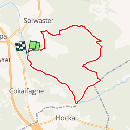

Lengte
14,5 km

Max. hoogte
593 m

Positief hoogteverschil
339 m
Km-Effort
19 km

Min. hoogte
365 m

Negatief hoogteverschil
338 m
Boucle
Ja
Datum van aanmaak :
2017-05-05 00:00:00.0
Laatste wijziging :
2017-05-05 00:00:00.0
4h00
Moeilijkheid : Onbekend

Gratisgps-wandelapplicatie
 SityTrail
IGN / Geografische instituten
SityTrail Plus
De wereld gaat voor u open
Over ons
Tocht Andere activiteiten van 14,5 km beschikbaar op Wallonië, Luik, Jalhay. Deze tocht wordt voorgesteld door misph.
Plaatsbepaling
Land:
Belgium
Regio :
Wallonië
Departement/Provincie :
Luik
Gemeente :
Jalhay
Locatie:
Sart
Vertrek:(Dec)
Vertrek:(UTM)
709885 ; 5599331 (31U) N.
Opmerkingen