


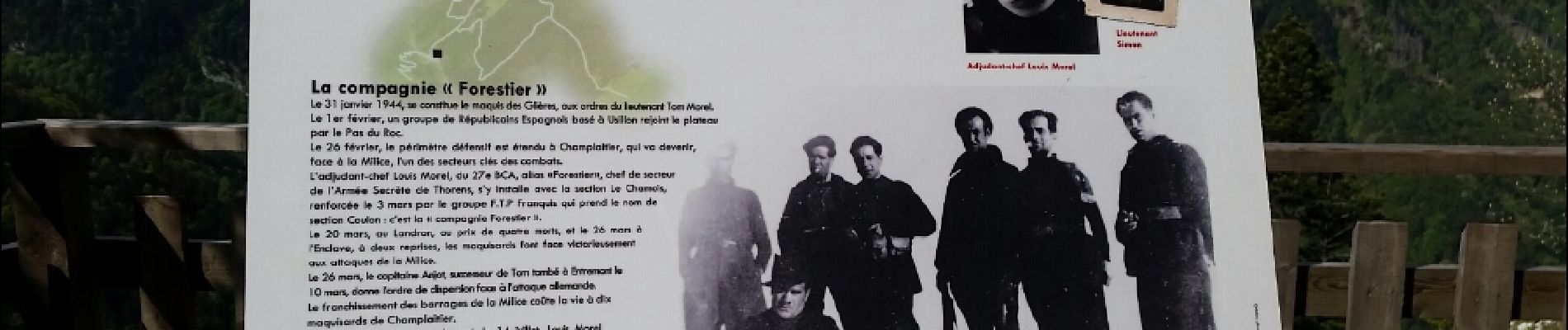
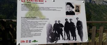
plateau des Glières par le pas du Roc

cailloux54
Gebruiker

Lengte
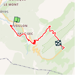
12,5 km

Max. hoogte
1595 m

Positief hoogteverschil
1038 m
Km-Effort
24 km

Min. hoogte
667 m

Negatief hoogteverschil
273 m
Boucle
Neen
Datum van aanmaak :
2016-11-30 00:00:00.0
Laatste wijziging :
2016-11-30 00:00:00.0
3h41
Moeilijkheid : Medium

Gratisgps-wandelapplicatie
 SityTrail
IGN / Geografische instituten
SityTrail Plus
De wereld gaat voor u open
Over ons
Tocht Stappen van 12,5 km beschikbaar op Auvergne-Rhône-Alpes, Haute-Savoie, Fillière. Deze tocht wordt voorgesteld door cailloux54.
Foto's


Plaatsbepaling
Land:
France
Regio :
Auvergne-Rhône-Alpes
Departement/Provincie :
Haute-Savoie
Gemeente :
Fillière
Locatie:
Thorens-Glières
Vertrek:(Dec)
Vertrek:(UTM)
288680 ; 5095909 (32T) N.
Opmerkingen