


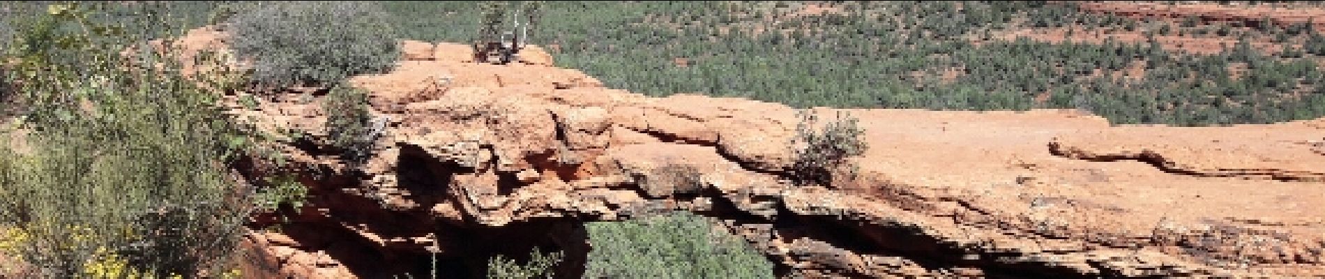
devil's Bridge

phi14
Gebruiker
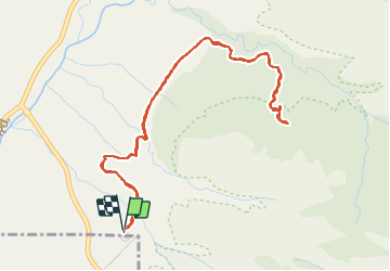

Lengte
7 km

Max. hoogte
1525 m

Positief hoogteverschil
160 m
Km-Effort
9,2 km

Min. hoogte
1405 m

Negatief hoogteverschil
161 m
Boucle
Ja
Datum van aanmaak :
2017-04-04 00:00:00.0
Laatste wijziging :
2017-04-04 00:00:00.0
2h02
Moeilijkheid : Gemakkelijk

Gratisgps-wandelapplicatie
 SityTrail
IGN / Geografische instituten
SityTrail Plus
De wereld gaat voor u open
Over ons
Tocht Stappen van 7 km beschikbaar op Arizona, Yavapai County. Deze tocht wordt voorgesteld door phi14.
Foto's


Plaatsbepaling
Land:
United States
Regio :
Arizona
Departement/Provincie :
Yavapai County
Gemeente :
Unknown
Locatie:
Unknown
Vertrek:(Dec)
Vertrek:(UTM)
425005 ; 3861195 (12S) N.
Opmerkingen