


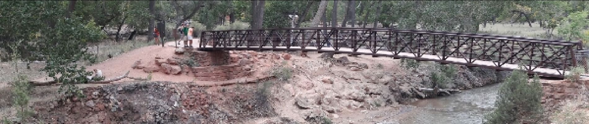
Angel's landing

phi14
Gebruiker
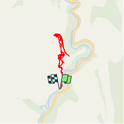

Lengte
9,6 km

Max. hoogte
1772 m

Positief hoogteverschil
1001 m
Km-Effort
23 km

Min. hoogte
1309 m

Negatief hoogteverschil
1002 m
Boucle
Ja
Datum van aanmaak :
2017-02-24 00:00:00.0
Laatste wijziging :
2017-02-24 00:00:00.0
4h58
Moeilijkheid : Moeilijk

Gratisgps-wandelapplicatie
 SityTrail
IGN / Geografische instituten
SityTrail Plus
De wereld gaat voor u open
Over ons
Tocht Stappen van 9,6 km beschikbaar op Utah, Washington County. Deze tocht wordt voorgesteld door phi14.
Beschrijving
C'est LA rando à faire à Zion. Splendide !!! Attention, sujet au vertige s'abstenir, la fin se fait sur une crête avec 400 m de vide de chaque côté.
Foto's


Plaatsbepaling
Land:
United States
Regio :
Utah
Departement/Provincie :
Washington County
Gemeente :
Unknown
Locatie:
Unknown
Vertrek:(Dec)
Vertrek:(UTM)
326948 ; 4125492 (12S) N.
Opmerkingen