


Chalet de Charvan

whisper73
Gebruiker

Lengte
37 km

Max. hoogte
1637 m

Positief hoogteverschil
1563 m
Km-Effort
58 km

Min. hoogte
382 m

Negatief hoogteverschil
1564 m
Boucle
Ja
Datum van aanmaak :
2016-10-02 00:00:00.0
Laatste wijziging :
2016-10-02 00:00:00.0
3h41
Moeilijkheid : Medium

Gratisgps-wandelapplicatie
 SityTrail
IGN / Geografische instituten
SityTrail Plus
De wereld gaat voor u open
Over ons
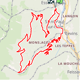
Tocht Mountainbike van 37 km beschikbaar op Auvergne-Rhône-Alpes, Savoie, Saint-Paul-sur-Isère. Deze tocht wordt voorgesteld door whisper73.
Plaatsbepaling
Land:
France
Regio :
Auvergne-Rhône-Alpes
Departement/Provincie :
Savoie
Gemeente :
Saint-Paul-sur-Isère
Locatie:
Unknown
Vertrek:(Dec)
Vertrek:(UTM)
300260 ; 5053940 (32T) N.
Opmerkingen