


L'ESCARENE LES ISSARDS

ccrelais
Gebruiker

Lengte
18,5 km

Max. hoogte
763 m

Positief hoogteverschil
775 m
Km-Effort
29 km

Min. hoogte
352 m

Negatief hoogteverschil
775 m
Boucle
Ja
Datum van aanmaak :
2016-10-06 00:00:00.0
Laatste wijziging :
2016-10-06 00:00:00.0
--
Moeilijkheid : Onbekend

Gratisgps-wandelapplicatie
 SityTrail
IGN / Geografische instituten
SityTrail Plus
De wereld gaat voor u open
Over ons
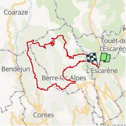
Tocht Mountainbike van 18,5 km beschikbaar op Provence-Alpes-Côte d'Azur, Alpes-Maritimes, L'Escarène. Deze tocht wordt voorgesteld door ccrelais.
Plaatsbepaling
Land:
France
Regio :
Provence-Alpes-Côte d'Azur
Departement/Provincie :
Alpes-Maritimes
Gemeente :
L'Escarène
Locatie:
Unknown
Vertrek:(Dec)
Vertrek:(UTM)
367602 ; 4854910 (32T) N.
Opmerkingen