


TCP 6

UDGI54
Gebruiker
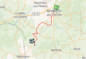

Lengte
29 km

Max. hoogte
257 m

Positief hoogteverschil
349 m
Km-Effort
34 km

Min. hoogte
147 m

Negatief hoogteverschil
414 m
Boucle
Neen
Datum van aanmaak :
2017-01-24 00:00:00.0
Laatste wijziging :
2017-01-24 00:00:00.0
--
Moeilijkheid : Onbekend

Gratisgps-wandelapplicatie
 SityTrail
IGN / Geografische instituten
SityTrail Plus
De wereld gaat voor u open
Over ons
Tocht Stappen van 29 km beschikbaar op Normandië, Orne, Mortagne-au-Perche. Deze tocht wordt voorgesteld door UDGI54.
Plaatsbepaling
Land:
France
Regio :
Normandië
Departement/Provincie :
Orne
Gemeente :
Mortagne-au-Perche
Locatie:
Unknown
Vertrek:(Dec)
Vertrek:(UTM)
318699 ; 5376955 (31U) N.
Opmerkingen