


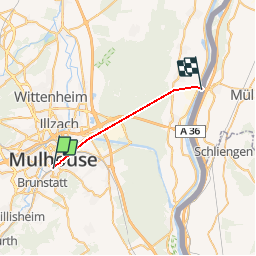
Grand Est - Ligne 32,7 - Mulhouse Chalampé

mich54
Gebruiker

Lengte
17,7 km

Max. hoogte
243 m

Positief hoogteverschil
90 m
Km-Effort
19 km

Min. hoogte
203 m

Negatief hoogteverschil
123 m
Boucle
Neen
Datum van aanmaak :
2017-03-03 00:00:00.0
Laatste wijziging :
2017-03-03 00:00:00.0
5m
Moeilijkheid : Onbekend

Gratisgps-wandelapplicatie
 SityTrail
IGN / Geografische instituten
SityTrail Plus
De wereld gaat voor u open
Over ons
Tocht Andere activiteiten van 17,7 km beschikbaar op Grand Est, Haut-Rhin, Mulhouse. Deze tocht wordt voorgesteld door mich54.
Beschrijving
En cours de traitement
(Concept protégé INPI)
Plaatsbepaling
Land:
France
Regio :
Grand Est
Departement/Provincie :
Haut-Rhin
Gemeente :
Mulhouse
Locatie:
Unknown
Vertrek:(Dec)
Vertrek:(UTM)
375715 ; 5288876 (32T) N.
Opmerkingen