


les en-cas aux infernets

Coryphene
Gebruiker

Lengte
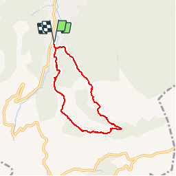
6,3 km

Max. hoogte
534 m

Positief hoogteverschil
311 m
Km-Effort
10,4 km

Min. hoogte
244 m

Negatief hoogteverschil
311 m
Boucle
Ja
Datum van aanmaak :
2017-05-25 00:00:00.0
Laatste wijziging :
2019-09-24 15:18:07.653
2h20
Moeilijkheid : Gemakkelijk

Gratisgps-wandelapplicatie
 SityTrail
IGN / Geografische instituten
SityTrail Plus
De wereld gaat voor u open
Over ons
Tocht Stappen van 6,3 km beschikbaar op Provence-Alpes-Côte d'Azur, Bouches-du-Rhône, Auriol. Deze tocht wordt voorgesteld door Coryphene.
Foto's


Plaatsbepaling
Land:
France
Regio :
Provence-Alpes-Côte d'Azur
Departement/Provincie :
Bouches-du-Rhône
Gemeente :
Auriol
Locatie:
Unknown
Vertrek:(Dec)
Vertrek:(UTM)
715603 ; 4803197 (31T) N.
Opmerkingen