


14,5 km | 20 km-effort


Gebruiker


Gratisgps-wandelapplicatie
 SityTrail
IGN / Geografische instituten
SityTrail World
De wereld gaat voor u open
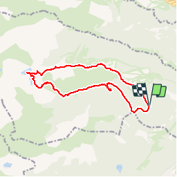
Tocht Stappen van 15,1 km beschikbaar op Occitanië, Pyrénées-Orientales, Formiguères. Deze tocht wordt voorgesteld door jcmartin.
Il est possible de partir du parking de la station de ski pour ceux qui ne veulent pas emprunter la piste en voiture, rajouter 120 m de dénivelé et la descente en fin de parcours à côté des pistes de ski est un peu plus raide.
Stappen

Stappen

Stappen
Stappen
Stappen
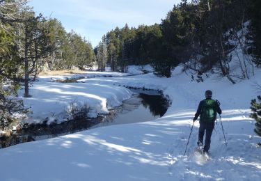
Sneeuwschoenen

Sneeuwschoenen
Sneeuwschoenen
Stappen