


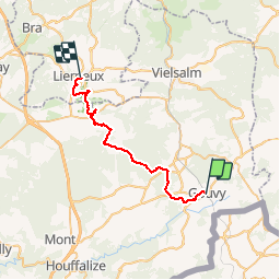
Luik: Gouvy - Lierneux - GR571 - 20170904

misph
Gebruiker

Lengte
28 km

Max. hoogte
579 m

Positief hoogteverschil
457 m
Km-Effort
35 km

Min. hoogte
416 m

Negatief hoogteverschil
506 m
Boucle
Neen
Datum van aanmaak :
2017-09-22 00:00:00.0
Laatste wijziging :
2017-09-22 00:00:00.0
6h13
Moeilijkheid : Onbekend

Gratisgps-wandelapplicatie
 SityTrail
IGN / Geografische instituten
SityTrail Plus
De wereld gaat voor u open
Over ons
Tocht Stappen van 28 km beschikbaar op Wallonië, Luxemburg, Gouvy. Deze tocht wordt voorgesteld door misph.
Beschrijving
Luik: Gouvy - Lierneux - GR571 - 20170904
Plaatsbepaling
Land:
Belgium
Regio :
Wallonië
Departement/Provincie :
Luxemburg
Gemeente :
Gouvy
Locatie:
Limerlé
Vertrek:(Dec)
Vertrek:(UTM)
710844 ; 5563926 (31U) N.
Opmerkingen