


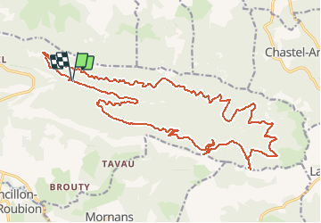
07/10/2017 Boucle Forêt de Saou

fiorano
Gebruiker

Lengte
27 km

Max. hoogte
1257 m

Positief hoogteverschil
1029 m
Km-Effort
41 km

Min. hoogte
418 m

Negatief hoogteverschil
1026 m
Boucle
Ja
Datum van aanmaak :
2017-10-09 00:00:00.0
Laatste wijziging :
2017-10-09 00:00:00.0
2h21
Moeilijkheid : Medium

Gratisgps-wandelapplicatie
 SityTrail
IGN / Geografische instituten
SityTrail Plus
De wereld gaat voor u open
Over ons
Tocht Mountainbike van 27 km beschikbaar op Auvergne-Rhône-Alpes, Drôme, Saou. Deze tocht wordt voorgesteld door fiorano.
Plaatsbepaling
Land:
France
Regio :
Auvergne-Rhône-Alpes
Departement/Provincie :
Drôme
Gemeente :
Saou
Locatie:
Unknown
Vertrek:(Dec)
Vertrek:(UTM)
667343 ; 4946993 (31T) N.
Opmerkingen