


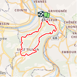
angleur . sart tilman . angleur

stef789
Gebruiker GUIDE

Lengte
11 km

Max. hoogte
251 m

Positief hoogteverschil
267 m
Km-Effort
14,6 km

Min. hoogte
77 m

Negatief hoogteverschil
271 m
Boucle
Neen
Datum van aanmaak :
2018-04-17 23:35:38.611
Laatste wijziging :
2018-04-17 23:35:38.611
2h18
Moeilijkheid : Gemakkelijk

Gratisgps-wandelapplicatie
 SityTrail
IGN / Geografische instituten
SityTrail Plus
De wereld gaat voor u open
Over ons
Tocht Stappen van 11 km beschikbaar op Wallonië, Luik, Luik. Deze tocht wordt voorgesteld door stef789.
Beschrijving
montée bois st laurent . descente bois st jacques via streupas
Plaatsbepaling
Land:
Belgium
Regio :
Wallonië
Departement/Provincie :
Luik
Gemeente :
Luik
Locatie:
Angleur
Vertrek:(Dec)
Vertrek:(UTM)
683074 ; 5609802 (31U) N.
Opmerkingen