


bar Michel . pont de beleu . centre nature . tout fagne wallonne. vallée helle . bar Michel

stef789
Gebruiker GUIDE
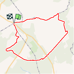

Lengte
16,7 km

Max. hoogte
680 m

Positief hoogteverschil
224 m
Km-Effort
19,7 km

Min. hoogte
579 m

Negatief hoogteverschil
223 m
Boucle
Ja
Datum van aanmaak :
2018-06-26 14:56:47.196
Laatste wijziging :
2018-06-26 14:56:47.196
3h46
Moeilijkheid : Gemakkelijk

Gratisgps-wandelapplicatie
 SityTrail
IGN / Geografische instituten
SityTrail Plus
De wereld gaat voor u open
Over ons
Tocht Stappen van 16,7 km beschikbaar op Wallonië, Luik, Waimes. Deze tocht wordt voorgesteld door stef789.
Plaatsbepaling
Land:
Belgium
Regio :
Wallonië
Departement/Provincie :
Luik
Gemeente :
Waimes
Locatie:
Robertville
Vertrek:(Dec)
Vertrek:(UTM)
291838 ; 5600426 (32U) N.
Opmerkingen