


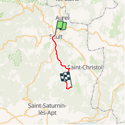
GR4-J02 - Sault - Les Esfourniaux

nfranche
Gebruiker

Lengte
18 km

Max. hoogte
1114 m

Positief hoogteverschil
716 m
Km-Effort
26 km

Min. hoogte
693 m

Negatief hoogteverschil
358 m
Boucle
Neen
Datum van aanmaak :
2019-01-15 12:14:08.984
Laatste wijziging :
2019-01-15 12:14:08.984
5h43
Moeilijkheid : Moeilijk

Gratisgps-wandelapplicatie
 SityTrail
IGN / Geografische instituten
SityTrail Plus
De wereld gaat voor u open
Over ons
Tocht Stappen van 18 km beschikbaar op Provence-Alpes-Côte d'Azur, Vaucluse, Sault. Deze tocht wordt voorgesteld door nfranche.
Plaatsbepaling
Land:
France
Regio :
Provence-Alpes-Côte d'Azur
Departement/Provincie :
Vaucluse
Gemeente :
Sault
Locatie:
Unknown
Vertrek:(Dec)
Vertrek:(UTM)
692744 ; 4884780 (31T) N.
Opmerkingen