


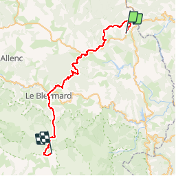
03 BastidePuylaurent-Finiels

nicolas54230
Gebruiker

Lengte
45 km

Max. hoogte
1699 m

Positief hoogteverschil
1562 m
Km-Effort
65 km

Min. hoogte
1032 m

Negatief hoogteverschil
1372 m
Boucle
Neen
Datum van aanmaak :
2019-01-15 12:32:47.408
Laatste wijziging :
2019-01-15 12:32:47.408
4h10
Moeilijkheid : Moeilijk

Gratisgps-wandelapplicatie
 SityTrail
IGN / Geografische instituten
SityTrail Plus
De wereld gaat voor u open
Over ons
Tocht Mountainbike van 45 km beschikbaar op Occitanië, Lozère, La Bastide-Puylaurent. Deze tocht wordt voorgesteld door nicolas54230.
Plaatsbepaling
Land:
France
Regio :
Occitanië
Departement/Provincie :
Lozère
Gemeente :
La Bastide-Puylaurent
Locatie:
Unknown
Vertrek:(Dec)
Vertrek:(UTM)
570901 ; 4936199 (31T) N.
Opmerkingen