Randonnée Marche Porspoder - Circuit de la pointe Garchine par les terres. - Photo

Circuit de la pointe Garchine par les terres.

 Dervalmarc
Dervalmarc

Utilisateur

© OpenStreetMap contributors
Longueur
Longueur
9,3 km
Altitude max
Altitude max
38 m
Dénivelé positif
Dénivelé positif
89 m
Km-Effort
Km-Effort  
10,5 km
Altitude min
Altitude min
2 m
Dénivelé négatif
Dénivelé négatif
90 m
Boucle
Boucle
Oui
Date de création :
2017-07-17 00:00:00.0
Dernière modification :
2017-07-17 00:00:00.0

(1 Avis)

Marche
Marche
2h57
Difficulté : Très facile

Scannez ce code QR pour ouvrir la randonnée dans l'application SityTrail

Application GPS de randonnée GRATUITE

Logo SityTrail SityTrail

IGN / Instituts géographiques

Télécharger SityTrail sur l'App Store Télécharger SityTrail sur Google Play

Logo SityTrail SityTrail World

Le monde est à vous

Télécharger SityTrail sur l'App Store Télécharger SityTrail sur Google Play Télécharger SityTrail sur Huawei AppGallery

À propos

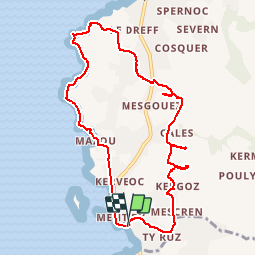
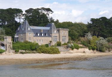
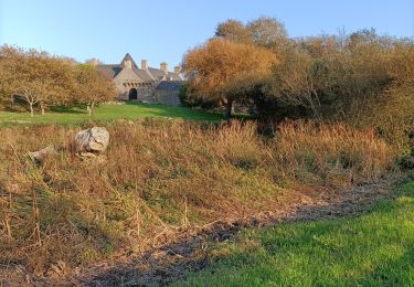
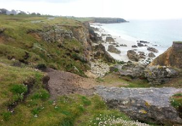
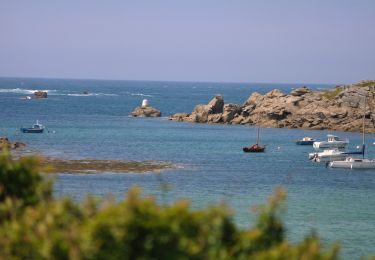
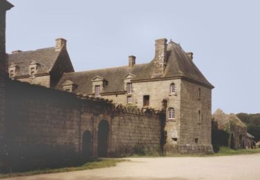
Randonnée Marche de 9,3 km à découvrir à Bretagne, Finistère, Porspoder. Cette randonnée est proposée par Dervalmarc.

Description

Randonnée entre l'Argoat et l'Armor.Circuit très varié entre route des lavoirs et megalithes.

Profil altimétrique

Photos

Localisation

Pays :
France
Région :
Bretagne
Département/Province :
Finistère
Commune :
Porspoder
Localité :
Unknown
Départ:(Dec)
Départ:(UTM)
369306 ; 5371481 (30U) N.

Commentaires

Veuillez vous connecter pour laisser un commentaire ou une note


Randonnées à proximité

Randonnée Marche Lanildut - Autour de Lanildut  - Photo
Marche
tracegps

Marche

Facile
(2)
Lanildut, Bretagne, Finistère, France
7 km | 8 km-effort
1h 45min
Oui
Randonnée Marche Lampaul-Plouarzel - 09.09.23  Lampaul- Plouarzel  -- Le Conquet - Photo
Marche
donda

Marche

Très difficile
Lampaul-Plouarzel, Bretagne, Finistère, France
21 km | 26 km-effort
5h 49min
Non
Randonnée Marche Lampaul-Plouarzel - Lanpaul - Lochrist - Photo
Marche
swp648

Marche

Moyen
Lampaul-Plouarzel, Bretagne, Finistère, France
19,8 km | 24 km-effort
5h 7min
Non
Randonnée Marche nordique Porspoder - porspoder - Photo
Marche nordique
elianette

Marche nordique

Très facile
Porspoder, Bretagne, Finistère, France
13,2 km | 14,4 km-effort
3h 13min
Oui
Randonnée Marche Lanildut - Aber Ildut - Tremazan - Photo
Marche
med88

Marche

Facile
Lanildut, Bretagne, Finistère, France
19,5 km | 22 km-effort
4h 42min
Non
Randonnée Marche Porspoder - GR 34 étape 32 - Photo
Marche
lagardienne

Marche

Facile
Porspoder, Bretagne, Finistère, France
33 km | 37 km-effort
8h 44min
Non
Randonnée Marche Lanildut - Lanildut Porspoder - Photo
Marche
cron

Marche

Moyen
(1)
Lanildut, Bretagne, Finistère, France
18,3 km | 21 km-effort
4h 34min
Oui
Randonnée Vélo Porspoder - Les Menhirs, circuit n°3 - Photo
Vélo
tracegps

Vélo

Moyen
Porspoder, Bretagne, Finistère, France
25 km | 29 km-effort
1h 30min
Oui
Randonnée V.T.T. Brélès - Espace VTT FFC du Pays d'Iroise- Circuit n° 12  - Photo
V.T.T.
tracegps

V.T.T.

Très difficile
Brélès, Bretagne, Finistère, France
65 km | 73 km-effort
4h 30min
Oui


Fermer
Mes abonnements