Randonnée Marche Canet-en-Roussillon - M66 CANET SUD - ST CYPRIEN PORT - AR - le 13.02.2018  - Photo

M66 CANET SUD - ST CYPRIEN PORT - AR - le 13.02.2018

 jeff66
jeff66

Utilisateur

© OpenStreetMap contributors
Longueur
Longueur
12,4 km
Altitude max
Altitude max
9 m
Dénivelé positif
Dénivelé positif
40 m
Km-Effort
Km-Effort  
13 km
Altitude min
Altitude min
-1 m
Dénivelé négatif
Dénivelé négatif
40 m
Boucle
Boucle
Oui
Date de création :
2018-04-17 18:50:57.471
Dernière modification :
2018-04-17 18:50:57.471

(0 Avis)

Marche
Marche
2h00
Difficulté : Facile

Scannez ce code QR pour ouvrir la randonnée dans l'application SityTrail

Application GPS de randonnée GRATUITE

Logo SityTrail SityTrail

IGN / Instituts géographiques

Télécharger SityTrail sur l'App Store Télécharger SityTrail sur Google Play

Logo SityTrail SityTrail World

Le monde est à vous

Télécharger SityTrail sur l'App Store Télécharger SityTrail sur Google Play Télécharger SityTrail sur Huawei AppGallery

À propos

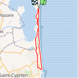
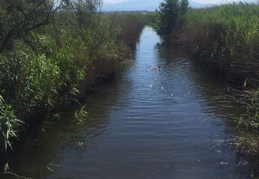
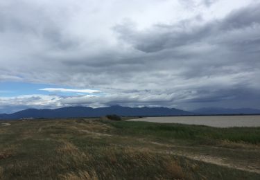
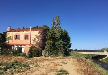
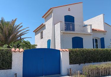
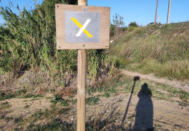
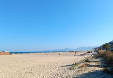
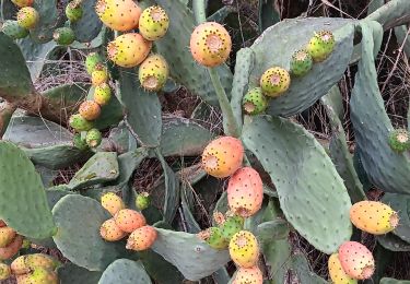
Randonnée Marche de 12,4 km à découvrir à Occitanie, Pyrénées-Orientales, Canet-en-Roussillon. Cette randonnée est proposée par jeff66.

Description

M66 CANET SUD - ST CYPRIEN PORT - AR - le 13.02.2018

Profil altimétrique

Localisation

Pays :
France
Région :
Occitanie
Département/Province :
Pyrénées-Orientales
Commune :
Canet-en-Roussillon
Localité :
Unknown
Départ:(Dec)
Départ:(UTM)
502747 ; 4724489 (31T) N.

Randonnées à proximité

Randonnée Marche Saint-Cyprien - SAINT-CYPRIEN 66 - front de mer - les CAPELLANS - Photo
Marche
jeff66

Marche

Facile
(2)
Saint-Cyprien, Occitanie, Pyrénées-Orientales, France
9,9 km | 10,3 km-effort
2h 11min
Oui
Randonnée Marche Saint-Nazaire - 66 SAINT-NAZAIRE - CABESTANY promenade dans le vignoble de galets - Photo
Marche
jeff66

Marche

Moyen
Saint-Nazaire, Occitanie, Pyrénées-Orientales, France
9 km | 9,9 km-effort
1h 29min
Oui
Randonnée Marche Canet-en-Roussillon - CANET-EN-ROUSSILLON 66 - entre TÊT, marais. étang et RÉART  - Photo
Marche
jeff66

Marche

Moyen
(1)
Canet-en-Roussillon, Occitanie, Pyrénées-Orientales, France
16,3 km | 17,5 km-effort
2h 49min
Oui
Randonnée Marche Canet-en-Roussillon - CANET-EN-ROUSSILLON 66 - entre mer, plage, dunes et étang - SAINT-CYPRIEN-PLAGE - Photo
Marche
jeff66

Marche

Moyen
Canet-en-Roussillon, Occitanie, Pyrénées-Orientales, France
12,5 km | 12,9 km-effort
2h 14min
Oui
Randonnée Marche Elne - ALENYA 66 - entre l'Agouille de la Mar et le Réart - Photo
Marche
jeff66

Marche

Facile
Elne, Occitanie, Pyrénées-Orientales, France
12,6 km | 13,1 km-effort
1h 57min
Oui
Randonnée Marche Saint-Cyprien - petit tour à St Cyprien  - Photo
Marche
stef789

Marche

Facile
Saint-Cyprien, Occitanie, Pyrénées-Orientales, France
10,4 km | 10,9 km-effort
3h 6min
Oui
Randonnée Marche Saint-Nazaire - st Nazaire  - Photo
Marche
rosemarie

Marche

Moyen
(1)
Saint-Nazaire, Occitanie, Pyrénées-Orientales, France
6,9 km | 7,3 km-effort
1h 50min
Non
Randonnée Marche Canet-en-Roussillon - Le canet, la plage des kèkès ... - Photo
Marche
stef789

Marche

Facile
Canet-en-Roussillon, Occitanie, Pyrénées-Orientales, France
4,3 km | 4,6 km-effort
1h 7min
Oui
Randonnée Marche Canet-en-Roussillon - petit tour à l´arboretum de Canet ... bof bof bof  - Photo
Marche
stef789

Marche

Facile
Canet-en-Roussillon, Occitanie, Pyrénées-Orientales, France
1,2 km | 1,2 km-effort
1h 8min
Oui


Fermer
Mes abonnements