Trail Motor Pont-Remy - pont Rémy en bateau - Photo

pont Rémy en bateau

 lefrancm
lefrancm

User

© OpenStreetMap contributors
Length
Length
12.7 km
Max alt
Max alt
14 m
Uphill gradient
Uphill gradient
67 m
Km-Effort
Km-Effort  
13.6 km
Min alt
Min alt
5 m
Downhill gradient
Downhill gradient
67 m
Boucle
Boucle
Yes
Creation date :
2014-12-10 00:00:00.0
Updated on :
2014-12-10 00:00:00.0

(0 Reviews)

Motor
Motor
1h20
Difficulty : Very easy

Scan this QR Code to open this trail in the SityTrail application

FREE GPS app for hiking

Logo SityTrail SityTrail

IGN / Geographical institutes

Download SityTrail from the App Store Download SityTrail from Google Play

Logo SityTrail SityTrail World

The world is yours!

Download SityTrail from the App Store Download SityTrail from Google Play Download SityTrail on Huawei AppGallery

About

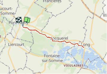
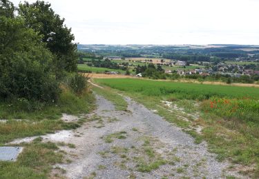
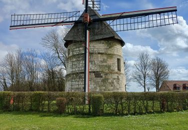
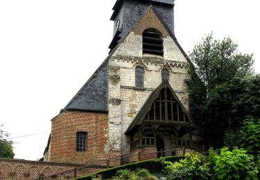
Trail Motor of 12.7 km to be discovered at Hauts-de-France, Somme, Pont-Remy. This trail is proposed by lefrancm.

Description

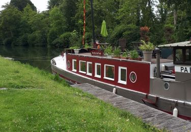
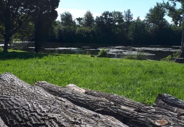
Balade en bateau sur le canal de la Somme entre Pont Rémy et Long

Elevation profile

Positioning

Country:
France
Region :
Hauts-de-France
Department/Province :
Somme
Municipality :
Pont-Remy
Location:
Unknown
Start:(UTM)
421757 ; 5545068 (31U) N.

Trails nearby

Trail On foot Eaucourt-sur-Somme - Le Moulin d'Eaucourt - Photo
On foot
PRO

On foot

Easy
Eaucourt-sur-Somme, Hauts-de-France, Somme, France
5.8 km | 7.3 km-effort
1h 39min
Yes
Trail On foot Long - Les Bords de Somme - Photo
On foot
PRO

On foot

Easy
Long, Hauts-de-France, Somme, France
7.9 km | 8.4 km-effort
1h 54min
Yes
Trail On foot Fontaine-sur-Somme - Les Hauts de Long - Photo
On foot
PRO

On foot

Easy
Fontaine-sur-Somme, Hauts-de-France, Somme, France
9.1 km | 11 km-effort
2h 29min
Yes
Trail Walking Eaucourt-sur-Somme - le moulin d'Eaucourt  - Photo
Walking
Luc Gengoux

Walking

Easy
Eaucourt-sur-Somme, Hauts-de-France, Somme, France
7.4 km | 9.1 km-effort
2h 23min
Yes
Trail Walking Pont-Remy - chemin de hallage et crête.  - Photo
Walking
Luc Gengoux

Walking

Very easy
Pont-Remy, Hauts-de-France, Somme, France
9.8 km | 11.6 km-effort
2h 34min
Yes
Trail Walking Long - Une randonnée rythmée par les étangs. - Photo
Walking
Luc Gengoux

Walking

Very easy
Long, Hauts-de-France, Somme, France
6.7 km | 7.1 km-effort
1h 53min
No
Trail Walking Eaucourt-sur-Somme - lp80_eaucourt - Photo
Walking
GR77LP

Walking

Medium
Eaucourt-sur-Somme, Hauts-de-France, Somme, France
7.2 km | 8.9 km-effort
2h 1min
Yes
Trail On foot Mareuil-Caubert - Les Etangs et Marais de Mareuil-Caubert - Photo
On foot
PRO

On foot

Easy
Mareuil-Caubert, Hauts-de-France, Somme, France
3.4 km | 3.6 km-effort
48min
No
Trail On foot Bailleul - Autour du bois de Bailleul - Photo
On foot
PRO

On foot

Easy
Bailleul, Hauts-de-France, Somme, France
7.6 km | 9.9 km-effort
2h 14min
No


Close
My subscriptions