Home
World
NEW
Premium
Shop
Trails
Articles
Help and support
Français
English
Nederlands
Español
Italiano
Deutsch
Log in
Home
World
Premium
Shop
Trails
Articles
Help and support
SityTrail
>
Points of interest
>
GC143AZ
SityTrail
>
Points of interest
>
GC143AZ
GC143AZ
Description
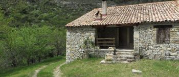
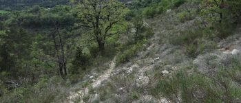
Montclus-Serres-l'Epine by Mir
Photos
GC143AZ can be discovered in the following trails...
tracegps
Col du Souffre et Lacs Mont-Coua
Walking
Difficult
(1)
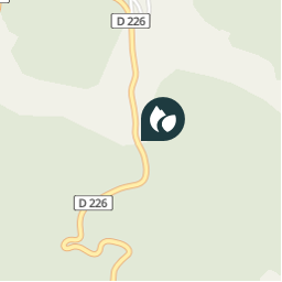
Les Allues, Auvergne-Rhône-Alpes, Savoy, France
25 km | 41 km-effort
7h 0min
Yes
tracegps
User
©
OpenStreetMap
contributors
Positioning
Country:
France
Region :
Provence-Alpes-Côte d'Azur
Department/Province :
Hautes-Alpes
Municipality :
L'Épine
Location:
Unknown
Positioning
44.407050004 / 5.612217011
Creation date :
2018-04-09 12:22:34.08
Updated on
2018-04-09 12:22:34.08
(0 Reviews)
Comments
Please log in to post a review or rate the element
Points of interest nearby
tracegps
GC143AZ
L'ÉPINE
tracegps
GC143AZ
L'ÉPINE
tracegps
GC143AZ
L'ÉPINE
tracegps
GC143AZ
L'ÉPINE
tracegps
GC143AZ
L'ÉPINE
CampingLesRivesduLac
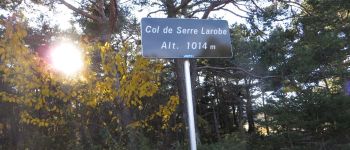
Serre Larobe
L'ÉPINE
CampingLesRivesduLac
Montée sur le Devès
MONTJAY
CampingLesRivesduLac
Vers Vaucluse haute
MONTJAY
Close
My subscriptions