Home
World
NEW
Premium
Shop
Trails
Articles
Help and support
Français
English
Nederlands
Español
Italiano
Deutsch
Log in
Home
World
Premium
Shop
Trails
Articles
Help and support
SityTrail
>
Points of interest
>
GC1113G
SityTrail
>
Points of interest
>
GC1113G
GC1113G
Description
The Highest Accessible Cache i
Photos
GC1113G can be discovered in the following trails...
tracegps
Dent du Villard depuis La Rosière
Walking
Difficult
(1)
Courchevel, Auvergne-Rhône-Alpes, Savoy, France
9.4 km | 19.2 km-effort
6h 0min
Yes
tracegps
User
©
OpenStreetMap
contributors
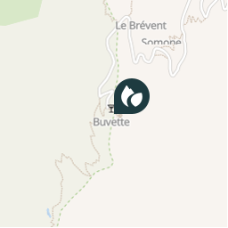
Positioning
Country:
France
Region :
Auvergne-Rhône-Alpes
Department/Province :
Upper Savoy
Municipality :
Chamonix-Mont-Blanc
Location:
Unknown
Positioning
45.933517 / 6.8376
Creation date :
2018-04-09 12:16:17.968
Updated on
2018-04-09 12:16:17.968
(0 Reviews)
Comments
Please log in to post a review or rate the element
Points of interest nearby
tracegps
GC1113G
CHAMONIX-MONT-BLANC
tracegps
GC1113G
CHAMONIX-MONT-BLANC
tracegps
GC1113G
CHAMONIX-MONT-BLANC
tracegps
GC1113G
CHAMONIX-MONT-BLANC
tracegps
GC1113G
CHAMONIX-MONT-BLANC
tracegps
GC1113G
CHAMONIX-MONT-BLANC
tracegps
GC1113G
CHAMONIX-MONT-BLANC
tracegps
GC1113G
CHAMONIX-MONT-BLANC
Close
My subscriptions