Home
World
NEW
Premium
Shop
Trails
Articles
Help and support
Français
English
Nederlands
Español
Italiano
Deutsch
Log in
Home
World
Premium
Shop
Trails
Articles
Help and support
SityTrail
>
Points of interest
>
GC17EVR
SityTrail
>
Points of interest
>
GC17EVR
GC17EVR
Description
Le sentier du fer by vilcanota
Photos
GC17EVR can be discovered in the following trails...
tracegps
Mont-Jovet depuis La Cour
Walking
Difficult
(1)
Bozel, Auvergne-Rhône-Alpes, Savoy, France
13.5 km | 27 km-effort
6h 0min
Yes
tracegps
User
©
OpenStreetMap
contributors
Positioning
Country:
France
Region :
Auvergne-Rhône-Alpes
Department/Province :
Isère
Municipality :
Le Haut-Bréda
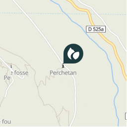
Location:
Pinsot
Positioning
45.373767 / 6.091017
Creation date :
2018-04-09 12:17:39.584
Updated on
2018-04-09 12:17:39.584
(0 Reviews)
Comments
Please log in to post a review or rate the element
Points of interest nearby
tracegps
GC17EVR
LE HAUT-BRÉDA
tracegps
GC17EVR
LE HAUT-BRÉDA
tracegps
GC17EVR
LE HAUT-BRÉDA
tracegps
GC17EVR
LE HAUT-BRÉDA
tracegps
GC17EVR
LE HAUT-BRÉDA
tracegps
GC17EVR
LE HAUT-BRÉDA
tracegps
GC17EVR
LE HAUT-BRÉDA
tracegps
GC17EVR
LE HAUT-BRÉDA
Close
My subscriptions