Home
World
NEW
Premium
Shop
Trails
Articles
Help and support
Français
English
Nederlands
Español
Italiano
Deutsch
Log in
Home
World
Premium
Shop
Trails
Articles
Help and support
SityTrail
>
Points of interest
>
Bifurcation GR36
SityTrail
>
Points of interest
>
Bifurcation GR36
Bifurcation GR36
Description
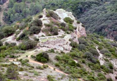
Vers le Signal d'Alaric
Photos
Bifurcation GR36 can be discovered in the following trails...
tracegps
Le signal d'Alaric et le Roc Gris - Moux
Walking
Medium
Moux, Occitania, Aude, France
13.6 km | 22 km-effort
5h 30min
Yes
tracegps
User
©
OpenStreetMap
contributors
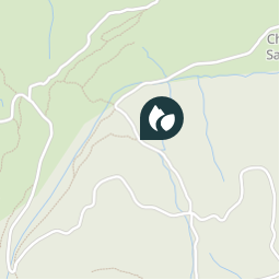
Positioning
Country:
France
Region :
Occitania
Department/Province :
Aude
Municipality :
Moux
Location:
Unknown
Positioning
43.158454 / 2.630611
Creation date :
2018-04-09 11:42:27.388
Updated on
2018-04-09 11:42:27.388
(0 Reviews)
Comments
Please log in to post a review or rate the element
Points of interest nearby
tracegps
Ruines bergerie
MOUX
tracegps
Roc Gris
MOUX
tracegps
La maiterie sans fin
MOUX
tracegps
Ruines prieuré St-Pierre
MOUX
tracegps
Le Signal d'Alaric
MOUX
Rando Apero Dodo
Bivouac
MOUX
tracegps
Bifurcation GR77
MOUX
tracegps
Parking Moux au pied de l'A62
MOUX
Close
My subscriptions