


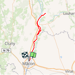

148 km | 165 km-effort


User


FREE GPS app for hiking
 SityTrail
IGN / Geographical institutes
SityTrail World
The world is yours!
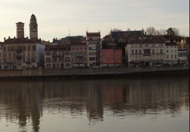
Trail Other activity of 90 km to be discovered at Bourgogne-Franche-Comté, Saône-et-Loire, Mâcon. This trail is proposed by BGO.
Voie bleu Macon Simandre sur 2 Jours couchage en chambre d'hote et retour en chambre d'hote
Walking


sport
Walking
Walking
Walking

Walking

Walking
Walking
Mountain bike