Trail Mountain bike Verfeil - De Verfeil à la Balerme - Photo

De Verfeil à la Balerme

 tracegps
tracegps

User

© OpenStreetMap contributors
Length
Length
13.9 km
Max alt
Max alt
261 m
Uphill gradient
Uphill gradient
295 m
Km-Effort
Km-Effort  
17.8 km
Min alt
Min alt
173 m
Downhill gradient
Downhill gradient
292 m
Boucle
Boucle
Yes
Creation date :
2014-12-10 00:00:00.0
Updated on :
2014-12-10 00:00:00.0

(0 Reviews)

Mountain bike
Mountain bike
1h10
Difficulty : Medium

Scan this QR Code to open this trail in the SityTrail application

FREE GPS app for hiking

Logo SityTrail SityTrail

IGN / Geographical institutes

Download SityTrail from the App Store Download SityTrail from Google Play

Logo SityTrail SityTrail World

The world is yours!

Download SityTrail from the App Store Download SityTrail from Google Play Download SityTrail on Huawei AppGallery

About

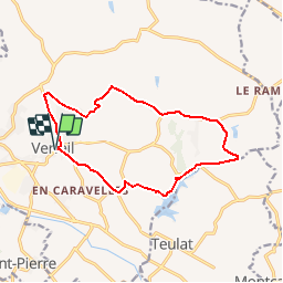
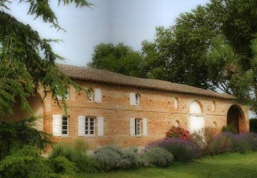
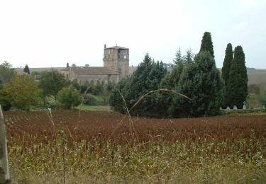
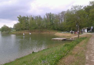
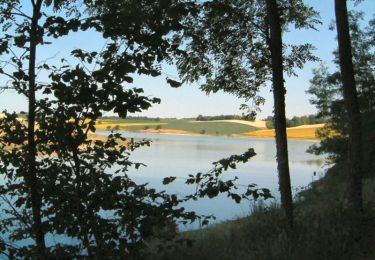
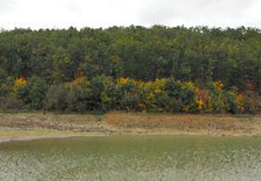
Trail Mountain bike of 13.9 km to be discovered at Occitania, Haute-Garonne, Verfeil. This trail is proposed by tracegps.

Description

Remarquable circuit à partir de Verfeil d'où on se précipite facilement vers le Lac de la Balerme. Il faut trouver son chemin au bout du lac avant de remonter vers En Charrac. Belle descente quand on quitte la route à Lasserre, bref, un parcours d'aventure !

Elevation profile

Photos

Positioning

Country:
France
Region :
Occitania
Department/Province :
Haute-Garonne
Municipality :
Verfeil
Location:
Unknown
Start:(UTM)
392079 ; 4834613 (31T) N.

Trails nearby

Trail Walking Verfeil - Le tour du lac de la Balerme - Photo
Walking
tracegps

Walking

Medium
(1)
Verfeil, Occitania, Haute-Garonne, France
10 km | 12.7 km-effort
2h 40min
Yes
Trail Walking Saint-Marcel-Paulel - Les sentiers de Saint Marcel Paulel - Photo
Walking
tracegps

Walking

Medium
(2)
Saint-Marcel-Paulel, Occitania, Haute-Garonne, France
8.7 km | 10.1 km-effort
2h 0min
Yes
Trail Walking Gragnague - Tour de Bonrepos Riquet - Photo
Walking
tracegps

Walking

Medium
(1)
Gragnague, Occitania, Haute-Garonne, France
9.7 km | 11.6 km-effort
2h 0min
Yes
Trail Running Teulat - Voir Teulat et courir ! - Photo
Running
tracegps

Running

Difficult
(1)
Teulat, Occitania, Tarn, France
18.2 km | 22 km-effort
1h 49min
Yes
Trail Walking Verfeil - tour du lac du laragou - Photo
Walking
christian425

Walking

Easy
Verfeil, Occitania, Haute-Garonne, France
5.1 km | 5.7 km-effort
1h 7min
Yes
Trail Walking Verfeil - Le tour du lac de Laragou - Photo
Walking
tracegps

Walking

Easy
Verfeil, Occitania, Haute-Garonne, France
4.8 km | 5.4 km-effort
1h 45min
Yes
Trail Running Saint-Marcel-Paulel - Les sentiers de Saint Marcel Paulel - Photo
Running
tracegps

Running

Medium
Saint-Marcel-Paulel, Occitania, Haute-Garonne, France
8.7 km | 10.1 km-effort
1h 0min
Yes
Trail Running Verfeil - De Verfeil à la Balerme - Photo
Running
tracegps

Running

Difficult
Verfeil, Occitania, Haute-Garonne, France
13.9 km | 17.8 km-effort
1h 30min
Yes
Trail Walking Verfeil - De Verfeil à la Balerme - Photo
Walking
tracegps

Walking

Difficult
Verfeil, Occitania, Haute-Garonne, France
13.9 km | 17.8 km-effort
3h 0min
Yes


Close
My subscriptions