


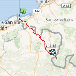

10.1 km | 17.1 km-effort

User


FREE GPS app for hiking
 SityTrail
IGN / Geographical institutes
SityTrail World
The world is yours!
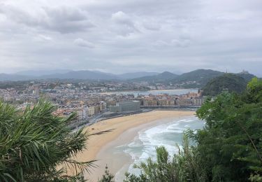
Trail Mountain bike of 64 km to be discovered at New Aquitaine, Pyrénées-Atlantiques, Hendaye. This trail is proposed by tracegps.
28 Juin 2005 Levés 6h, la température élevée et la moiteur nous ont empêché de passer une bonne nuit. Il est 8h quand on est au départ devant le "beau" batiment en béton de la plage d'Hendaye (point de depart du GR10). On zigzague dans les rues d'Hendaye pour trouver le chemin qui monte au col d'Ibardin ..... La suite du récit est ICI


Walking

Walking
Walking

Walking

Walking
On foot
Walking
Walking
Walking