Trail Walking Bagnères-de-Luchon - Tour par Port de Venasque - Photo

Tour par Port de Venasque

 tracegps
tracegps

User

© OpenStreetMap contributors
Length
Length
10.2 km
Max alt
Max alt
2488 m
Uphill gradient
Uphill gradient
412 m
Km-Effort
Km-Effort  
18.5 km
Min alt
Min alt
1379 m
Downhill gradient
Downhill gradient
1270 m
Boucle
Boucle
No
Creation date :
2014-12-10 00:00:00.0
Updated on :
2014-12-10 00:00:00.0

(0 Reviews)

Walking
Walking
3h00
Difficulty : Difficult

Scan this QR Code to open this trail in the SityTrail application

FREE GPS app for hiking

Logo SityTrail SityTrail

IGN / Geographical institutes

Download SityTrail from the App Store Download SityTrail from Google Play

Logo SityTrail SityTrail World

The world is yours!

Download SityTrail from the App Store Download SityTrail from Google Play Download SityTrail on Huawei AppGallery

About

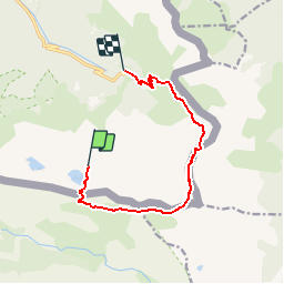
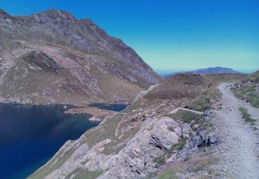
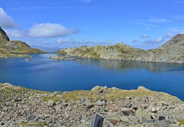
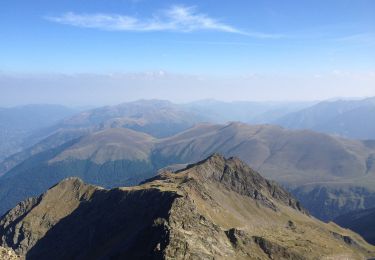
Trail Walking of 10.2 km to be discovered at Occitania, Haute-Garonne, Bagnères-de-Luchon. This trail is proposed by tracegps.

Description

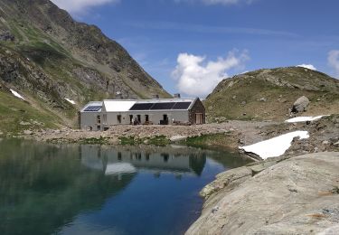
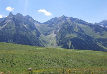
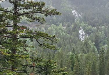
Départ du refuge de Venasque vers le Port de Venasque dont on voit le passage à la dernière minute ! Point de vue extraordinaire sur les Pyrénées Espagnoles. Puis retour par la vallée et les crètes de Crabidès. Ne pas se tromper au pas la Mounjoye, à gauche suivre le chemin escarpé et prudence. Puis descente tranquille avant de replonger vers l'Hospice de France.

Elevation profile

Photos

Positioning

Country:
France
Region :
Occitania
Department/Province :
Haute-Garonne
Municipality :
Bagnères-de-Luchon
Location:
Unknown
Start:(UTM)
306925 ; 4730170 (31T) N.

Trails nearby

Trail Walking Bagnères-de-Luchon - 2022-06-28_22h13m18_chemin_de_l'impératrice_entre_l'hospice_de_france_ - Photo
Walking
ego

Walking

Medium
(1)
Bagnères-de-Luchon, Occitania, Haute-Garonne, France
5.4 km | 8.8 km-effort
2h 0min
No
Trail Walking Bagnères-de-Luchon - pic de Sauvegarde - Photo
Walking
dawed311

Walking

Medium
(2)
Bagnères-de-Luchon, Occitania, Haute-Garonne, France
9.7 km | 25 km-effort
3h 9min
No
Trail Walking Bagnères-de-Luchon - Pic de Pouylané - Entecade - Hospice de France - Photo
Walking
tracegps

Walking

Difficult
(1)
Bagnères-de-Luchon, Occitania, Haute-Garonne, France
10.6 km | 24 km-effort
5h 39min
Yes
Trail Walking Bagnères-de-Luchon - boums du Port de Venasque - Photo
Walking
chrisgps

Walking

Very difficult
Bagnères-de-Luchon, Occitania, Haute-Garonne, France
10.7 km | 23 km-effort
5h 6min
Yes
Trail Walking Bagnères-de-Luchon - l'Entecade en boucle depuis l'hospice de France  - Photo
Walking
GUIDE
lhomme.ph

Walking

Medium
Bagnères-de-Luchon, Occitania, Haute-Garonne, France
12.2 km | 26 km-effort
6h 36min
No
Trail Walking Benasque - Arboretum Turpi - Photo
Walking
ilur56

Walking

Easy
Benasque, Aragon, Huesca, Spain
3.2 km | 5.3 km-effort
1h 9min
Yes
Trail On foot Bagnères-de-Luchon - Refuge et Port de Vénasque - Photo
On foot
PRO

On foot

Easy
Bagnères-de-Luchon, Occitania, Haute-Garonne, France
6.3 km | 16.9 km-effort
3h 50min
No
Trail On foot Bagnères-de-Luchon - Pic de la Sauvegarde - Photo
On foot
PRO

On foot

Medium
Bagnères-de-Luchon, Occitania, Haute-Garonne, France
7.7 km | 21 km-effort
4h 50min
No
Trail On foot Bagnères-de-Luchon - Le Pic de la Montagnette depuis l'Hospice de France - Photo
On foot
PRO

On foot

Medium
Bagnères-de-Luchon, Occitania, Haute-Garonne, France
13.6 km | 28 km-effort
6h 25min
No


Close
My subscriptions