


17.1 km | 25 km-effort

User


FREE GPS app for hiking
 SityTrail
IGN / Geographical institutes
SityTrail World
The world is yours!
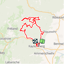
Trail Mountain bike of 38 km to be discovered at Grand Est, Haut-Rhin, Kaysersberg-Vignoble. This trail is proposed by tracegps.
Source: Cyclo-Club Colmar Vous pouvez débuter ce circuit en traversant Kaysersberg. Prenez ensuite la piste cyclable, direction Fréland pour atteindre Alspach et l'oratoire St Jean. A partir de là le macadam disparaît et les premières montées manifestent leur présence. Le chemin est large et souvent empierré et la montée ne requiert que du souffle. Vous aurez une petite descente après la première route macadamée qui mène à Ursprung, puis des faux-plat et petites montées pour rejoindre la route au-dessus de St Alexis. La boucle suivante vous mènera vers le carrefour du Sapin des Français et à la Roche du Tétras. Attention peu avant de rejoindre le col du Koenigstuhl, vous aurez droit à un raidillon.... La suite et une carte détaillée sont ICI


Walking

Walking
Walking
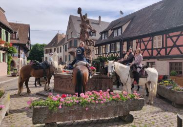
Horseback riding

Walking
Horseback riding

Walking

Walking
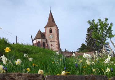
Walking
Ammershwihr