


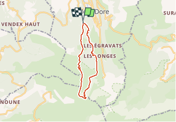

17.7 km | 24 km-effort


User


FREE GPS app for hiking
 SityTrail
IGN / Geographical institutes
SityTrail World
The world is yours!
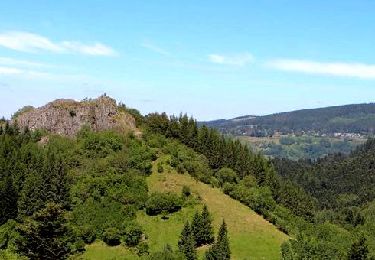
Trail Walking of 10.4 km to be discovered at Auvergne-Rhône-Alpes, Puy-de-Dôme, Mont-Dore. This trail is proposed by Orage.
J1 Parking salon du Capucin Via Ferrata Capucin GR30 bivouac à la Carrière
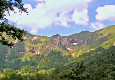
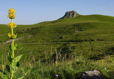
J2 Puy de Cliergue Tour Carrée Col de Courre (avec option sommet du Sancy)descente par val de Courre et retour parking par chemin des médecins
Walking
Walking

Walking
Walking
Walking
Walking
Walking

Walking

Walking