


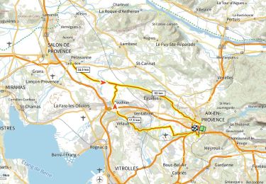
65 km | 94 km-effort


User


FREE GPS app for hiking
 SityTrail
IGN / Geographical institutes
SityTrail World
The world is yours!
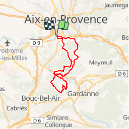
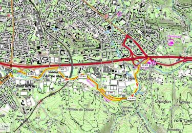
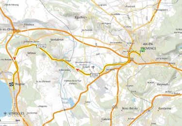
Trail Mountain bike of 25 km to be discovered at Provence-Alpes-Côte d'Azur, Bouches-du-Rhône, Aix-en-Provence. This trail is proposed by tracegps.
Au départ de Pont de l'Arc, une boucle VTT de 25 km qui emprunte les meilleurs sentiers du Montaiguet et des collines de Bouc. Retour par les bords de l'Arc.


Walking
Mountain bike
Walking
Walking
Road bike
Walking
Other activity
Walking
Walking