


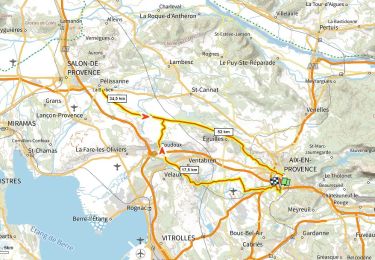
65 km | 94 km-effort


User


FREE GPS app for hiking
 SityTrail
IGN / Geographical institutes
SityTrail World
The world is yours!
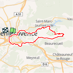
Trail Mountain bike of 30 km to be discovered at Provence-Alpes-Côte d'Azur, Bouches-du-Rhône, Aix-en-Provence. This trail is proposed by tracegps.
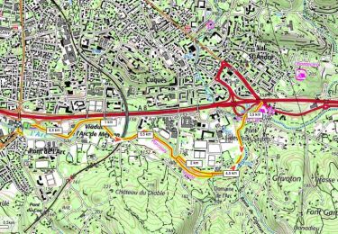
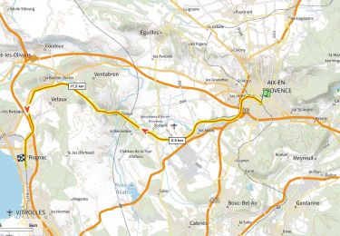
Traversée d'Aix en Provence par le Cours Mirabeau via La Rotonde pour rejoindre au plus vite la Sainte Victoire, avec au menu, vue sur le barrage Zola, le barrage Bimont, montée jusqu'au refuge Cézanne, passage au pied de la Sainte Victoire, retour par la route Cezanne, et les bords de l'Arc. Le parcours démarre près de la gare routière où se trouvent quelques parkings gratuits et payants. Belles montées: la première sur le bitume pour accéder au site de la Sainte Victoire et la deuxième pour rejoindre le rejuge Cézanne. Attention à la redescente du refuge il y a de grosses marches. L'été le massif est fermé entre juin et septembre.

Walking
Mountain bike
Walking
Walking
Road bike
Walking
Other activity
Walking
Road bike