Trail Walking Évisa - Capu a u Cuccula - Photo

Capu a u Cuccula

 tracegps
tracegps

User

© OpenStreetMap contributors
Length
Length
13.9 km
Max alt
Max alt
2031 m
Uphill gradient
Uphill gradient
959 m
Km-Effort
Km-Effort  
27 km
Min alt
Min alt
1110 m
Downhill gradient
Downhill gradient
958 m
Boucle
Boucle
Yes
Creation date :
2014-12-10 00:00:00.0
Updated on :
2014-12-10 00:00:00.0

(0 Reviews)

Walking
Walking
9h00
Difficulty : Medium

Scan this QR Code to open this trail in the SityTrail application

FREE GPS app for hiking

Logo SityTrail SityTrail

IGN / Geographical institutes

Download SityTrail from the App Store Download SityTrail from Google Play

Logo SityTrail SityTrail World

The world is yours!

Download SityTrail from the App Store Download SityTrail from Google Play Download SityTrail on Huawei AppGallery

About

Trail Walking of 13.9 km to be discovered at Corsica, South Corsica, Évisa. This trail is proposed by tracegps.

Description

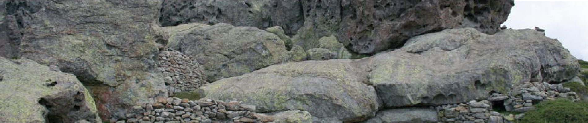
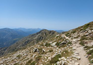
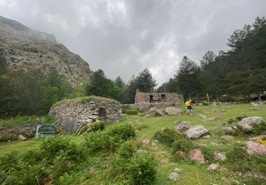
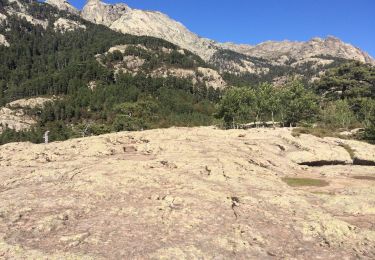
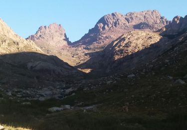
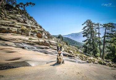
Au nord du col de Verghio, Paglia Orba est bien entendu le sommet vedette ; si vous recherchez un belvédère d'accès plus facile dans ce secteur, Capu a u Cuccula est un excellent candidat, avec une vue remarquable sur Capu Tafonatu, Paglia Orba et les hauts sommets de la Corse, mais aussi sur le golfe de Porto (sauf en cas de météo brumeuse comme le jour de notre visite). L'itinéraire décrit ici démarre au village de vacances d'Aitone ; ses seules difficultés sont liées à l'absence de balisage et aux massifs d'aulnes dont il convient de négocier la traversée.

Elevation profile

Photos

Points of interest

Point of interest Évisa - Aitone - Photo
tracegps
ÉVISA 
Point of interest Évisa - Bergerie Piazze - Photo
tracegps
Point of interest Évisa - Bocca Saltu - Photo
tracegps
ÉVISA 
Point of interest Évisa - Cuccula - Photo
tracegps
ÉVISA 

Positioning

Country:
France
Region :
Corsica
Department/Province :
South Corsica
Municipality :
Évisa
Location:
Unknown
Start:(UTM)
486986 ; 4679714 (32T) N.

Trails nearby

Trail Walking Albertacce - Bivouac dans le GR 20 via lac Nino - Photo
Walking
Sebastienburette

Walking

Medium
(1)
Albertacce, Corsica, Haute-Corse, France
9.8 km | 17.6 km-effort
5h 5min
No
Trail Walking Albertacce - Guy Goujon - Photo
Walking
bdettebernard48

Walking

Medium
(1)
Albertacce, Corsica, Haute-Corse, France
4 km | 8.6 km-effort
Unknown
Yes
Trail Walking Albertacce - Castel du Vergio refuge de Mangani - Photo
Walking
GUIDE
Roger Philippe Wallez

Walking

Very difficult
Albertacce, Corsica, Haute-Corse, France
15.8 km | 24 km-effort
5h 17min
No
Trail Walking Évisa - Corse 2023: Evisa - Refuge de Puscaghia - Photo
Walking
dauzata

Walking

Difficult
Évisa, Corsica, South Corsica, France
16.6 km | 29 km-effort
6h 35min
No
Trail Walking Évisa - Evisa forêt d’aitone  - Photo
Walking
GUIDE
antignacs

Walking

Easy
Évisa, Corsica, South Corsica, France
13.4 km | 19.7 km-effort
4h 11min
Yes
Trail Walking Évisa - gorges spelunca - Photo
Walking
fab0202

Walking

Easy
Évisa, Corsica, South Corsica, France
4.7 km | 7.5 km-effort
1h 46min
No
Trail Walking Albertacce - Trou du diable du capu tafunatu - Photo
Walking
PVERTICAL

Walking

Medium
Albertacce, Corsica, Haute-Corse, France
15.4 km | 29 km-effort
5h 40min
Yes
Trail Walking Albertacce - col de Vergio refuge Ciuttulu di i mori GR 20 A/R - Photo
Walking
inesmyt

Walking

Very difficult
(1)
Albertacce, Corsica, Haute-Corse, France
14.3 km | 24 km-effort
4h 57min
Yes
Trail Walking Albertacce - Cascade de Radule - Photo
Walking
cathymac20

Walking

Easy
(1)
Albertacce, Corsica, Haute-Corse, France
3.8 km | 5.7 km-effort
1h 11min
Yes


Close
My subscriptions