Trail Walking Gavarnie-Gèdre - Faja de las Flores - Photo
 tracegps
tracegps

User

© OpenStreetMap contributors
Length
Length
22 km
Max alt
Max alt
2828 m
Uphill gradient
Uphill gradient
1668 m
Km-Effort
Km-Effort  
45 km
Min alt
Min alt
2198 m
Downhill gradient
Downhill gradient
1666 m
Boucle
Boucle
Yes
Creation date :
2014-12-10 00:00:00.0
Updated on :
2014-12-10 00:00:00.0

(1 Reviews)

Walking
Walking
13h00
Difficulty : Very difficult

Scan this QR Code to open this trail in the SityTrail application

FREE GPS app for hiking

Logo SityTrail SityTrail

IGN / Geographical institutes

Download SityTrail from the App Store Download SityTrail from Google Play

Logo SityTrail SityTrail World

The world is yours!

Download SityTrail from the App Store Download SityTrail from Google Play Download SityTrail on Huawei AppGallery

About

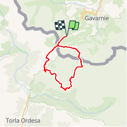
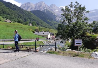
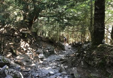
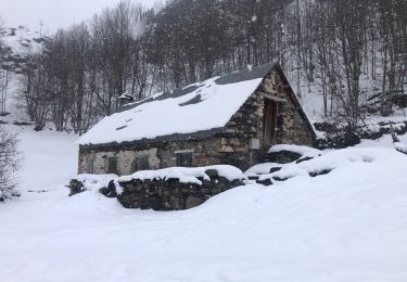
Trail Walking of 22 km to be discovered at Occitania, Hautespyrenees, Gavarnie-Gèdre. This trail is proposed by tracegps.

Description

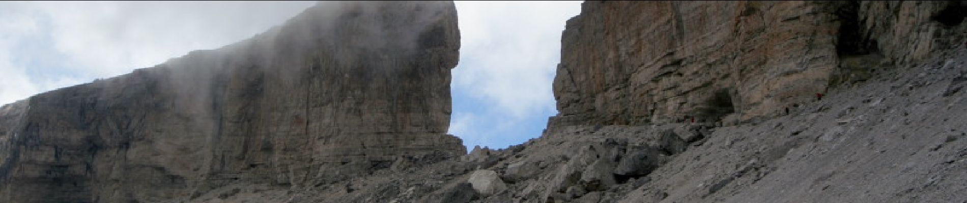
Sans doute une des boucles les plus extraordinaires au départ du col de Tente, près de Gavarnie ! Elle fait découvrir la corniche de l'Escusana très peu fréquentée, Mondarruego (2842m), un belvédère sur la région d'Ordessa, l'incroyable Faja de las Flores (une vire presque parfaite de plusieurs kilomètres), puis le retour par la Brèche de Roland...

Elevation profile

Photos

Points of interest

Point of interest Fanlo - Abri - Photo
tracegps
FANLO 
Point of interest Fanlo - Breche de Roland - Photo
tracegps
Point of interest Gavarnie-Gèdre - Col de Boucharo - Photo
tracegps
GAVARNIE-GÈDRE 
Point of interest Torla-Ordesa - Col de Forqueta - Photo
tracegps
TORLA-ORDESA 
Point of interest Torla-Ordesa - Debut Vire Escusana - Photo
tracegps
TORLA-ORDESA 
Point of interest Fanlo - Debut vire las Flores - Photo
tracegps
Point of interest Torla-Ordesa - Fin Vire Escusana - Photo
tracegps
TORLA-ORDESA 
Point of interest Fanlo - Fin vire las Flores - Photo
tracegps
Point of interest Fanlo - Mondarruego - Photo
tracegps
Point of interest Gavarnie-Gèdre - Pkg Tentes - Photo
tracegps
GAVARNIE-GÈDRE 
Point of interest Gavarnie-Gèdre - Refuge des Sarradets - Photo
tracegps
GAVARNIE-GÈDRE 

Positioning

Country:
France
Region :
Occitania
Department/Province :
Hautespyrenees
Municipality :
Gavarnie-Gèdre
Location:
Gavarnie
Start:(UTM)
741500 ; 4733191 (30T) N.

Comments

Please log in to post a review or rate the element


ce guide m'a bien aidé même si certaines parties pourraient être améliorées dont la montée vers la brèche de Roland.


Trails nearby

Trail Walking Torla-Ordesa - Soum Blanc des Espécières-Col des Tentes - Photo
Walking
1037

Walking

Difficult
(7)
Torla-Ordesa, Aragon, Huesca, Spain
4 km | 5.7 km-effort
1h 42min
No
Trail Walking Gavarnie-Gèdre - Lac de la Bernatoire - Photo
Walking
2034

Walking

Medium
(8)
Gavarnie-Gèdre, Occitania, Hautespyrenees, France
12.7 km | 22 km-effort
4h 36min
Yes
Trail Walking Gavarnie-Gèdre - Breche de Rolland - Photo
Walking
reneperrin

Walking

Easy
(3)
Gavarnie-Gèdre, Occitania, Hautespyrenees, France
12.1 km | 22 km-effort
4h 34min
Yes
Trail Walking Gavarnie-Gèdre - Le Cirque de Gavarnie autrement - Photo
Walking
tracegps

Walking

Medium
(2)
Gavarnie-Gèdre, Occitania, Hautespyrenees, France
9.1 km | 15.6 km-effort
3h 0min
Yes
Trail Walking Gavarnie-Gèdre - Le Soum Blanc des Especières 2685m depuis le col de Tentes - Photo
Walking
tracegps

Walking

Difficult
(2)
Gavarnie-Gèdre, Occitania, Hautespyrenees, France
5.6 km | 12.6 km-effort
3h 0min
Yes
Trail Walking Gavarnie-Gèdre - Le Casque du Marboré 3006m depuis le col de Tentes (2208m)  - Photo
Walking
tracegps

Walking

Very difficult
(1)
Gavarnie-Gèdre, Occitania, Hautespyrenees, France
7 km | 16.4 km-effort
7h 0min
No
Trail Walking Gavarnie-Gèdre - GAVARNIE avec Pierre D, Christine et Michel Blavit 3740150 - Photo
Walking
GUIDE
marmotte65

Walking

Difficult
Gavarnie-Gèdre, Occitania, Hautespyrenees, France
10.5 km | 17.2 km-effort
3h 53min
Yes
Trail Walking Torla-Ordesa - St Nicolas au col de Bujuarelo 13 km - Photo
Walking
GUIDE
rvapeldo

Walking

Difficult
Torla-Ordesa, Aragon, Huesca, Spain
14.2 km | 29 km-effort
8h 15min
Yes
Trail Horseback riding Gavarnie-Gèdre - Cirque de Gavarnie et variante  - Photo
Horseback riding
orsel

Horseback riding

Easy
Gavarnie-Gèdre, Occitania, Hautespyrenees, France
29 km | 37 km-effort
3h 12min
No


Close
My subscriptions