Trail Mountain bike Saint-Baudille-de-la-Tour - VTT Nord Isère 2008 40 kms - Photo
 tracegps
tracegps

User

© OpenStreetMap contributors
Length
Length
38 km
Max alt
Max alt
378 m
Uphill gradient
Uphill gradient
513 m
Km-Effort
Km-Effort  
45 km
Min alt
Min alt
262 m
Downhill gradient
Downhill gradient
506 m
Boucle
Boucle
No
Creation date :
2014-12-10 00:00:00.0
Updated on :
2014-12-10 00:00:00.0

(2 Reviews)

Mountain bike
Mountain bike
3h00
Difficulty : Difficult

Scan this QR Code to open this trail in the SityTrail application

FREE GPS app for hiking

Logo SityTrail SityTrail

IGN / Geographical institutes

Download SityTrail from the App Store Download SityTrail from Google Play

Logo SityTrail SityTrail World

The world is yours!

Download SityTrail from the App Store Download SityTrail from Google Play Download SityTrail on Huawei AppGallery

About

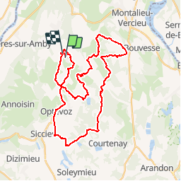
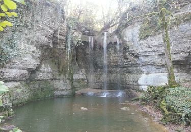
Trail Mountain bike of 38 km to be discovered at Auvergne-Rhône-Alpes, Isère, Saint-Baudille-de-la-Tour. This trail is proposed by tracegps.

Description

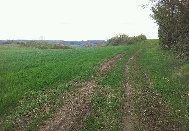
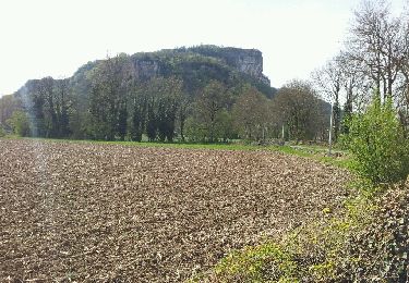
Parcours du 40 km de la 11eme édition de la VTT Nord Isère. Paysages magnifiques autour de Sainte Baudille (nombreux étangs dont celui de LEMPS, site protégé). Attention toutefois, certains chemins privés sont ouverts seulement à l'occasion de la rando.

Elevation profile

Positioning

Country:
France
Region :
Auvergne-Rhône-Alpes
Department/Province :
Isère
Municipality :
Saint-Baudille-de-la-Tour
Location:
Unknown
Start:(UTM)
681748 ; 5073122 (31T) N.

Comments

Please log in to post a review or rate the element


Trails nearby

Trail Walking Charette - Cascade de la Roche - Photo
Walking
Marchopier

Walking

Easy
Charette, Auvergne-Rhône-Alpes, Isère, France
9 km | 10.4 km-effort
2h 8min
Yes
Trail Walking Saint-Baudille-de-la-Tour - Et Baudille de la tour - Photo
Walking
jpbo

Walking

Easy
Saint-Baudille-de-la-Tour, Auvergne-Rhône-Alpes, Isère, France
12 km | 14 km-effort
3h 11min
Yes
Trail Walking Hières-sur-Amby - Hieres sur Amby - Photo
Walking
elcanario

Walking

Medium
(1)
Hières-sur-Amby, Auvergne-Rhône-Alpes, Isère, France
14.4 km | 19.5 km-effort
4h 27min
Yes
Trail Mountain bike Hières-sur-Amby - hyeres sur amby optevoz  - Photo
Mountain bike
marc6262

Mountain bike

Medium
Hières-sur-Amby, Auvergne-Rhône-Alpes, Isère, France
19.4 km | 25 km-effort
2h 26min
Yes
Trail Mountain bike La Balme-les-Grottes - Joli tour cascade de la roche - Photo
Mountain bike
marc6262

Mountain bike

Medium
La Balme-les-Grottes, Auvergne-Rhône-Alpes, Isère, France
23 km | 28 km-effort
1h 59min
Yes
Trail Walking Charette - La Craz St Baudille - Photo
Walking
Marchopier

Walking

Easy
Charette, Auvergne-Rhône-Alpes, Isère, France
9 km | 11.5 km-effort
2h 39min
Yes
Trail Walking Saint-Vulbas - Saint vulbac - Photo
Walking
papajp

Walking

Saint-Vulbas, Auvergne-Rhône-Alpes, Ain, France
11.3 km | 12.1 km-effort
59min
No
Trail Walking Optevoz - rando cascade de la roche - Photo
Walking
tyax93

Walking

Easy
Optevoz, Auvergne-Rhône-Alpes, Isère, France
16.2 km | 19.2 km-effort
4h 36min
Yes
Trail Walking Annoisin-Chatelans - De Chatelans à Larina - Photo
Walking
tracegps

Walking

Medium
Annoisin-Chatelans, Auvergne-Rhône-Alpes, Isère, France
6.9 km | 9.8 km-effort
2h 0min
Yes


Close
My subscriptions