Trail Walking Saint-Cyr-sur-Mer - calanque du cap d'Alon - sentier des vignes - sentier côtier - Photo

calanque du cap d'Alon - sentier des vignes - sentier côtier

 gildascb
gildascb

User

© OpenStreetMap contributors
Length
Length
10 km
Max alt
Max alt
99 m
Uphill gradient
Uphill gradient
262 m
Km-Effort
Km-Effort  
13.5 km
Min alt
Min alt
0 m
Downhill gradient
Downhill gradient
272 m
Boucle
Boucle
No
Creation date :
2019-01-15 15:10:04.563
Updated on :
2021-08-12 16:16:00.175

(0 Reviews)

Walking
Walking
3h22
Difficulty : Easy

Scan this QR Code to open this trail in the SityTrail application

FREE GPS app for hiking

Logo SityTrail SityTrail

IGN / Geographical institutes

Download SityTrail from the App Store Download SityTrail from Google Play

Logo SityTrail SityTrail World

The world is yours!

Download SityTrail from the App Store Download SityTrail from Google Play Download SityTrail on Huawei AppGallery

About

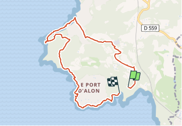
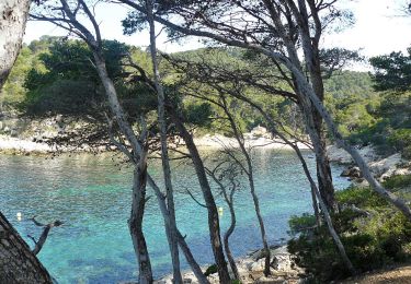
Trail Walking of 10 km to be discovered at Provence-Alpes-Côte d'Azur, Var, Saint-Cyr-sur-Mer. This trail is proposed by gildascb.

Description

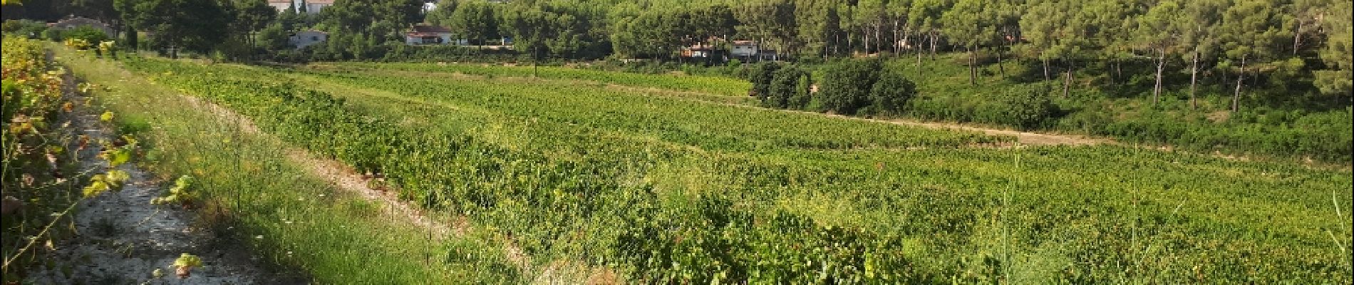
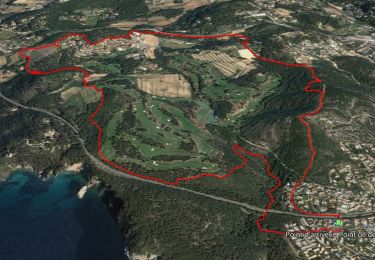
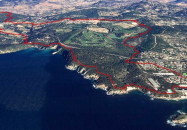
Belle boucle entre les vignes et le sentier du littoral avec de magnifiques panoramas.
Le sentier des vignes et le sentier côtier sont très bien balisés (jaune).
Attention, entre la pointe Grenier et la Pointe Fauconnière, le sentier est fermé pour cause d'éboulement. Nous avons donc contourné cette zone.

Cette boucle peut se démarrer de plusieurs endroits. Nous avons décidé de la commencer au niveau du parking bas de la Calanque du cap d'Alon pour pouvoir finir par une baignade dans la calanque !

PS : prévoir plutôt des chaussures de marche ou de sport (passages un peu caillouteux - nu-pieds à éviter).

Elevation profile

Photos

Positioning

Country:
France
Region :
Provence-Alpes-Côte d'Azur
Department/Province :
Var
Municipality :
Saint-Cyr-sur-Mer
Location:
Unknown
Start:(UTM)
720548 ; 4780924 (31T) N.

Trails nearby

Trail Walking Bandol - SityTrail - fregate - Photo
Walking
GUIDE
affinetataille

Walking

Easy
(1)
Bandol, Provence-Alpes-Côte d'Azur, Var, France
8.7 km | 11.4 km-effort
3h 15min
Yes
Trail Walking Bandol - SityTrail - Tour du golf de la Fregate (version longue ) - Photo
Walking
GUIDE
affinetataille

Walking

Very difficult
(1)
Bandol, Provence-Alpes-Côte d'Azur, Var, France
13.5 km | 19 km-effort
4h 19min
Yes
Trail Walking Saint-Cyr-sur-Mer - St Cyr  - Bandol - Photo
Walking
kephas

Walking

Medium
(1)
Saint-Cyr-sur-Mer, Provence-Alpes-Côte d'Azur, Var, France
16.1 km | 21 km-effort
4h 53min
No
Trail Walking Saint-Cyr-sur-Mer - Port d'Alon - Bandol - Port d'Alon - Photo
Walking
tracegps

Walking

Medium
(1)
Saint-Cyr-sur-Mer, Provence-Alpes-Côte d'Azur, Var, France
7.7 km | 9.9 km-effort
2h 0min
Yes
Trail Walking Saint-Cyr-sur-Mer - Le Port d'Alon - Photo
Walking
tracegps

Walking

Medium
(2)
Saint-Cyr-sur-Mer, Provence-Alpes-Côte d'Azur, Var, France
9.4 km | 12.8 km-effort
3h 0min
Yes
Trail Walking Bandol - Rando Bandol - Port d'Alon - Bandol - Photo
Walking
tracegps

Walking

Difficult
(1)
Bandol, Provence-Alpes-Côte d'Azur, Var, France
7.2 km | 9.4 km-effort
2h 30min
Yes
Trail On foot Saint-Cyr-sur-Mer - Sentier du littoral (Saint-Cyr-sur-Mer) - Photo
On foot
PRO

On foot

Easy
Saint-Cyr-sur-Mer, Provence-Alpes-Côte d'Azur, Var, France
4.9 km | 6.5 km-effort
1h 27min
No
Trail Walking Bandol - SityTrail - Boucle Bandol - Port d'Alon - Dune de sable - La Madrague - Port d'Alon - Bandol - Photo
Walking
GUIDE
affinetataille

Walking

Medium
(2)
Bandol, Provence-Alpes-Côte d'Azur, Var, France
14.1 km | 19.7 km-effort
6h 0min
Yes
Trail Walking Bandol - bandol baie des nations - Photo
Walking
bopapa

Walking

Very easy
(1)
Bandol, Provence-Alpes-Côte d'Azur, Var, France
13.2 km | 16.8 km-effort
5h 44min
Yes


Close
My subscriptions