Trail Walking Saint-Maurice - Le vallon des Bouys - Photo
 tracegps
tracegps

User

© OpenStreetMap contributors
Length
Length
4.4 km
Max alt
Max alt
497 m
Uphill gradient
Uphill gradient
158 m
Km-Effort
Km-Effort  
6.5 km
Min alt
Min alt
340 m
Downhill gradient
Downhill gradient
154 m
Boucle
Boucle
Yes
Creation date :
2014-12-10 00:00:00.0
Updated on :
2014-12-10 00:00:00.0

(0 Reviews)

Walking
Walking
1h40
Difficulty : Easy

Scan this QR Code to open this trail in the SityTrail application

FREE GPS app for hiking

Logo SityTrail SityTrail

IGN / Geographical institutes

Download SityTrail from the App Store Download SityTrail from Google Play

Logo SityTrail SityTrail World

The world is yours!

Download SityTrail from the App Store Download SityTrail from Google Play Download SityTrail on Huawei AppGallery

About

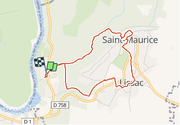
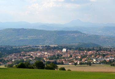
Trail Walking of 4.4 km to be discovered at Auvergne-Rhône-Alpes, Puy-de-Dôme, Saint-Maurice. This trail is proposed by tracegps.

Description

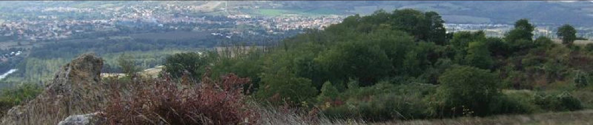
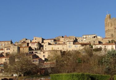
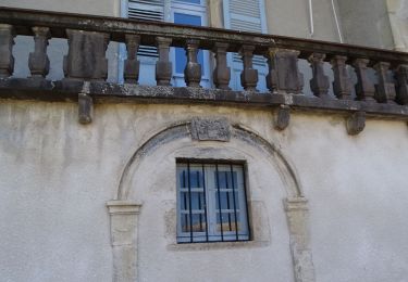
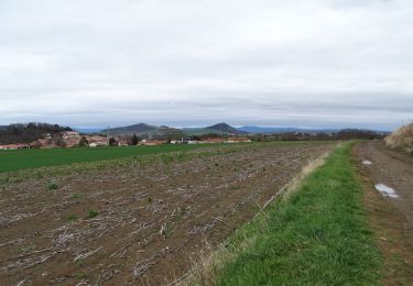
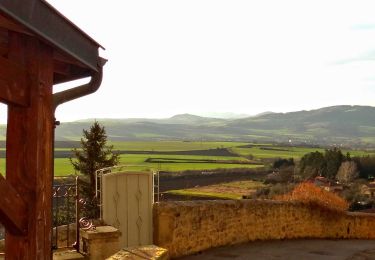
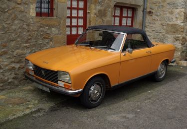
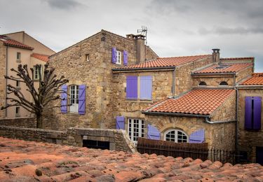
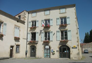
Circuit Chamina raccourci. Le charmant petit village de Lissac vaut vraiment qu'on s'y attarde... Les photos montrent ce que peuvent découvrir ceux qui feront la balade complète de Chamina (10 km). Balade numérisée sur le terrain par Jean louis Phillipart. Retrouvez cette randonnée dans le topo Guide Chamina Au Fil de l’Allier.

Elevation profile

Photos

Positioning

Country:
France
Region :
Auvergne-Rhône-Alpes
Department/Province :
Puy-de-Dôme
Municipality :
Saint-Maurice
Location:
Unknown
Start:(UTM)
517383 ; 5056983 (31T) N.

Trails nearby

Trail Walking Montpeyroux - Montpeyroux_Arkose - Photo
Walking
GUIDE
jagarnier

Walking

Easy
(1)
Montpeyroux, Auvergne-Rhône-Alpes, Puy-de-Dôme, France
8.6 km | 11.2 km-effort
2h 30min
Yes
Trail Walking Vic-le-Comte - Vic_le_Comte_Bassin_2 - Photo
Walking
GUIDE
jagarnier

Walking

Medium
(1)
Vic-le-Comte, Auvergne-Rhône-Alpes, Puy-de-Dôme, France
12.5 km | 16.6 km-effort
3h 45min
Yes
Trail Walking Authezat - Authezat Horaire - Photo
Walking
guy63

Walking

Medium
(1)
Authezat, Auvergne-Rhône-Alpes, Puy-de-Dôme, France
7.4 km | 8.6 km-effort
2h 45min
Yes
Trail On foot Saint-Georges-sur-Allier - Saint-Georges-sur-Allier - Photo
On foot
guy63

On foot

Medium
(1)
Saint-Georges-sur-Allier, Auvergne-Rhône-Alpes, Puy-de-Dôme, France
5.6 km | 7.7 km-effort
2h 30min
Yes
Trail Walking Parent - Parent_Montpeyroux - Photo
Walking
GUIDE
jagarnier

Walking

Medium
(1)
Parent, Auvergne-Rhône-Alpes, Puy-de-Dôme, France
9.8 km | 13.4 km-effort
2h 45min
Yes
Trail Walking Vic-le-Comte - Entre vignes et comté - Photo
Walking
tracegps

Walking

Medium
(1)
Vic-le-Comte, Auvergne-Rhône-Alpes, Puy-de-Dôme, France
8.6 km | 10.8 km-effort
2h 30min
Yes
Trail On foot Montpeyroux - Montpeyroux - Photo
On foot
PRO

On foot

Easy
Montpeyroux, Auvergne-Rhône-Alpes, Puy-de-Dôme, France
3.9 km | 5.3 km-effort
1h 12min
No
Trail On foot Authezat - Sur le Chemin de l'Arkose - Photo
On foot
PRO

On foot

Easy
Authezat, Auvergne-Rhône-Alpes, Puy-de-Dôme, France
8.7 km | 11.2 km-effort
2h 33min
Yes
Trail On foot Authezat - Les Forts de la Sauvetat - Photo
On foot
PRO

On foot

Easy
Authezat, Auvergne-Rhône-Alpes, Puy-de-Dôme, France
7.1 km | 8.3 km-effort
1h 52min
No


Close
My subscriptions