Trail Mountain bike Wissembourg - Traversée du Massif Vosgien - Photo

Traversée du Massif Vosgien

 tracegps
tracegps

User

© OpenStreetMap contributors
Length
Length
393 km
Max alt
Max alt
1251 m
Uphill gradient
Uphill gradient
12764 m
Km-Effort
Km-Effort  
563 km
Min alt
Min alt
158 m
Downhill gradient
Downhill gradient
12586 m
Boucle
Boucle
No
Creation date :
2014-12-10 00:00:00.0
Updated on :
2014-12-10 00:00:00.0

(0 Reviews)

Mountain bike
Mountain bike
192h00
Difficulty : Difficult

Scan this QR Code to open this trail in the SityTrail application

FREE GPS app for hiking

Logo SityTrail SityTrail

IGN / Geographical institutes

Download SityTrail from the App Store Download SityTrail from Google Play

Logo SityTrail SityTrail World

The world is yours!

Download SityTrail from the App Store Download SityTrail from Google Play Download SityTrail on Huawei AppGallery

About

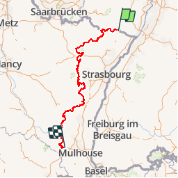
Trail Mountain bike of 393 km to be discovered at Grand Est, Bas-Rhin, Wissembourg. This trail is proposed by tracegps.

Description

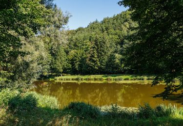
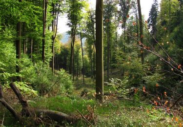
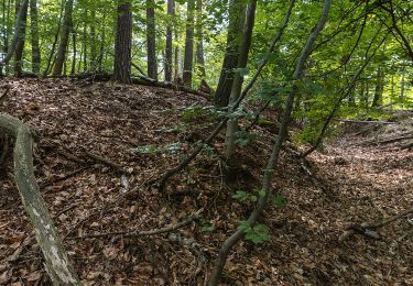
De Wissembourg à Thann, vous roulerez dans le parc régional des Vosges du nord ainsi que le parc naturel régional des ballons d’Alsace, tout en traversant le piémont des Vosges. Cet itinéraire permanent est jalonné par des villes, villages, fermes auberges, curiosités locales, lacs et escales panoramiques. De difficultés physique et technique différentes, cette traversée emprunte des passages à flanc de collines, des chemins traversant vallées et forêts. Expert, confirmé, débutant ou famille trouveront dans cette traversée une large palette de sensations, de découvertes ou simplement du bonheur.

Elevation profile

Positioning

Country:
France
Region :
Grand Est
Department/Province :
Bas-Rhin
Municipality :
Wissembourg
Location:
Unknown
Start:(UTM)
422607 ; 5432257 (32U) N.

Trails nearby

Trail On foot Wissembourg - Rotes Kreuz - Photo
On foot
PRO

On foot

Easy
Wissembourg, Grand Est, Bas-Rhin, France
6.5 km | 9.6 km-effort
2h 11min
No
Trail On foot Wissembourg - Disque vert - Photo
On foot
PRO

On foot

Easy
Wissembourg, Grand Est, Bas-Rhin, France
8.9 km | 12.9 km-effort
2h 56min
No
Trail On foot Wissembourg - Anneau rouge - Photo
On foot
PRO

On foot

Easy
Wissembourg, Grand Est, Bas-Rhin, France
7.4 km | 9.6 km-effort
2h 11min
Yes
Trail On foot Wissembourg - Anneau vert - Photo
On foot
PRO

On foot

Easy
Wissembourg, Grand Est, Bas-Rhin, France
13.5 km | 18.3 km-effort
4h 9min
Yes
Trail On foot Dörrenbach - Weg der Aussichten, Dörrenbach - Photo
On foot
PRO

On foot

Easy
Dörrenbach, Rhineland-Palatinate, Landkreis Südliche Weinstraße, Germany
5.3 km | 7.9 km-effort
1h 47min
No
Trail On foot Schweigen-Rechtenbach - Rund ums Steinbühl Schweigen-Rechtenbach - Photo
On foot
PRO

On foot

Easy
Schweigen-Rechtenbach, Rhineland-Palatinate, Landkreis Südliche Weinstraße, Germany
7.8 km | 11.1 km-effort
2h 31min
No
Trail On foot Schweigen-Rechtenbach - Ruine Guttenberg Tour Schweigen-Rechtenbach - Photo
On foot
PRO

On foot

Easy
Schweigen-Rechtenbach, Rhineland-Palatinate, Landkreis Südliche Weinstraße, Germany
10.2 km | 14.2 km-effort
3h 13min
Yes
Trail On foot Wissembourg - Grenzland Tour Schweigen-Rechtenbach - Photo
On foot
PRO

On foot

Easy
Wissembourg, Grand Est, Bas-Rhin, France
11.3 km | 15.5 km-effort
3h 30min
Yes
Trail On foot Oberotterbach - Weg der Geschichte, Oberotterbach - Photo
On foot
PRO

On foot

Easy
Oberotterbach, Rhineland-Palatinate, Landkreis Südliche Weinstraße, Germany
11.4 km | 15.6 km-effort
3h 32min
Yes


Close
My subscriptions