Trail Mountain bike Mayreville - 15° rando de la PIEGE 2009 - Photo

15° rando de la PIEGE 2009

 tracegps
tracegps

User

© OpenStreetMap contributors
Length
Length
34 km
Max alt
Max alt
364 m
Uphill gradient
Uphill gradient
784 m
Km-Effort
Km-Effort  
45 km
Min alt
Min alt
243 m
Downhill gradient
Downhill gradient
783 m
Boucle
Boucle
Yes
Creation date :
2014-12-10 00:00:00.0
Updated on :
2014-12-10 00:00:00.0

(0 Reviews)

Mountain bike
Mountain bike
3h30
Difficulty : Difficult

Scan this QR Code to open this trail in the SityTrail application

FREE GPS app for hiking

Logo SityTrail SityTrail

IGN / Geographical institutes

Download SityTrail from the App Store Download SityTrail from Google Play

Logo SityTrail SityTrail World

The world is yours!

Download SityTrail from the App Store Download SityTrail from Google Play Download SityTrail on Huawei AppGallery

About

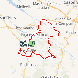
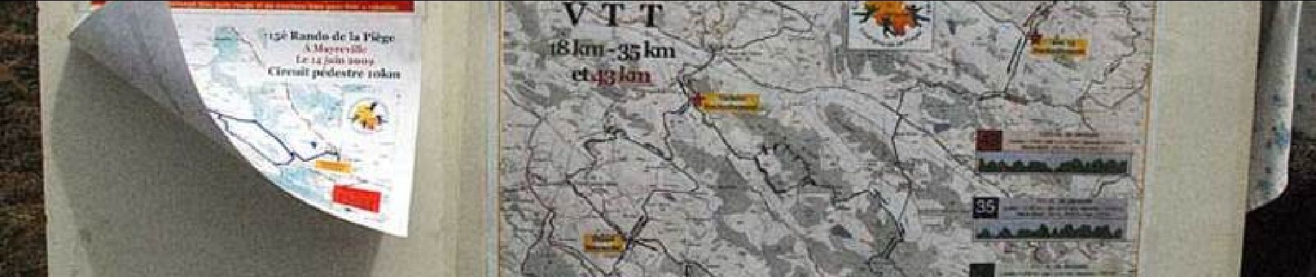
Trail Mountain bike of 34 km to be discovered at Occitania, Aude, Mayreville. This trail is proposed by tracegps.

Description

Un évènement organisé par le Vélo Club Salhersien. On peut télécharger la fiche descriptive du circuit.

Elevation profile

Photos

Positioning

Country:
France
Region :
Occitania
Department/Province :
Aude
Municipality :
Mayreville
Location:
Unknown
Start:(UTM)
405899 ; 4788086 (31T) N.

Trails nearby

Trail Walking Saint-Amans - Saint amans  - Photo
Walking
Mamilaure

Walking

Medium
(1)
Saint-Amans, Occitania, Aude, France
7.9 km | 10.9 km-effort
1h 59min
Yes
Trail Walking Saint-Amans - st amans - Photo
Walking
cappelle

Walking

Easy
(1)
Saint-Amans, Occitania, Aude, France
7.6 km | 10.5 km-effort
2h 24min
Yes


Close
My subscriptions