Trail Walking Camps-sur-l'Agly - Gorges de Galamus par Nissol - Photo

Gorges de Galamus par Nissol

 tracegps
tracegps

User

© OpenStreetMap contributors
Length
Length
14.9 km
Max alt
Max alt
724 m
Uphill gradient
Uphill gradient
685 m
Km-Effort
Km-Effort  
24 km
Min alt
Min alt
279 m
Downhill gradient
Downhill gradient
694 m
Boucle
Boucle
No
Creation date :
2014-12-10 00:00:00.0
Updated on :
2014-12-10 00:00:00.0

(2 Reviews)

Walking
Walking
5h00
Difficulty : Difficult

Scan this QR Code to open this trail in the SityTrail application

FREE GPS app for hiking

Logo SityTrail SityTrail

IGN / Geographical institutes

Download SityTrail from the App Store Download SityTrail from Google Play

Logo SityTrail SityTrail World

The world is yours!

Download SityTrail from the App Store Download SityTrail from Google Play Download SityTrail on Huawei AppGallery

About

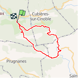
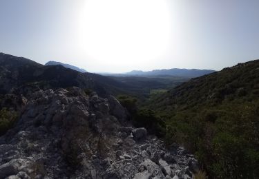
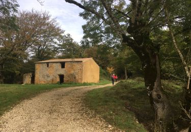
Trail Walking of 14.9 km to be discovered at Occitania, Aude, Camps-sur-l'Agly. This trail is proposed by tracegps.

Description

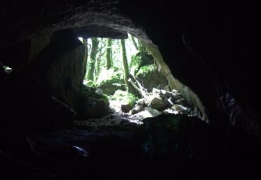
Hermitage ouvert du 2 avril au 30 octobre ne pas faire la randonnée en été par fortes chaleurs: sentier peu ombragé (eau,boissons hermitage Galamus et Moulin de Cubières) Laisser le véhicule au premier parking à l'entrée de Camps/Agly, descendre la route, prendre le premier chemin à droite,franchir le gué,monter à la Bergerie de Mondy,rejoindre le Pla de Lagual, prendre le GR36 légèrement à gauche jusqu'à la rivière Agly, la traverser au réservoir de la Tirounère, prendre le sentier qui monte à la départementale D7, la prendre à gauche, au fond du premier parking sentier vers l'hermitage, sortir de l'hermitage par le tunnel, rejoindre la D7, la prendre à Gauche pendant 3,5 Km (traversée des Gorges de Galamus) après le moulin de Cubières,quitter la départementale à gauche, suivre la rivière,monter à gauche, rejoindre le chemin du départ,rejoindre Camps/Agly .

Elevation profile

Photos

Positioning

Country:
France
Region :
Occitania
Department/Province :
Aude
Municipality :
Camps-sur-l'Agly
Location:
Unknown
Start:(UTM)
453839 ; 4745309 (31T) N.

Comments

Please log in to post a review or rate the element


Ce circuit n'est plus faisable en totalité en période de fortes eaux (avril 2016).La passerelle de la Tirounère est détruite et il n'est plus possible de traverser l'Agly.Dommage car la randonnée est très belle.


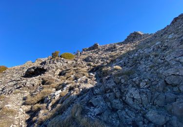
superbe rando avec une variante à partir réservoir suivre fléchage jaune direction camps attention passage difficile et dangereux pour enfants.


Trails nearby

Trail Walking Bugarach - Le Pech de Bugarach 1230 m, depuis le Col du Linas - Photo
Walking
tracegps

Walking

Medium
(2)
Bugarach, Occitania, Aude, France
10.5 km | 20 km-effort
5h 45min
Yes
Trail Walking Bugarach - le Pech de Bugarach - Lac de La vène - Photo
Walking
jacques delaporte

Walking

Difficult
Bugarach, Occitania, Aude, France
9.3 km | 17.8 km-effort
6h 12min
No
Trail Walking Saint-Paul-de-Fenouillet - La Quille - Photo
Walking
suresnois

Walking

Very difficult
Saint-Paul-de-Fenouillet, Occitania, Pyrénées-Orientales, France
16.9 km | 29 km-effort
6h 23min
No
Trail Walking Saint-Paul-de-Fenouillet - Autour des gorges de Galamus - Photo
Walking
suresnois

Walking

Very difficult
Saint-Paul-de-Fenouillet, Occitania, Pyrénées-Orientales, France
12.4 km | 22 km-effort
6h 28min
Yes
Trail Walking Prugnanes - roc paradet - Photo
Walking
suresnois

Walking

Very difficult
Prugnanes, Occitania, Pyrénées-Orientales, France
11.3 km | 19.4 km-effort
5h 58min
Yes
Trail Walking Bugarach - Col du Linas-Pech de Bugarach-La fenêtre  - Photo
Walking
Repi Newlife

Walking

Medium
Bugarach, Occitania, Aude, France
6.2 km | 15.1 km-effort
3h 30min
No
Trail Walking Sougraigne - Source De La Sals à Sougraigne - Photo
Walking
PI11

Walking

Easy
Sougraigne, Occitania, Aude, France
14.6 km | 22 km-effort
5h 29min
Yes
Trail Walking Saint-Paul-de-Fenouillet - st Paul de fenouinlet / col lenty et retour - Photo
Walking
Erius

Walking

Difficult
Saint-Paul-de-Fenouillet, Occitania, Pyrénées-Orientales, France
9.6 km | 15.6 km-effort
2h 59min
Yes
Trail Walking Bugarach - Bugarach - Fontaine salée (La Salz) - Photo
Walking
PiloudeBamako

Walking

Medium
Bugarach, Occitania, Aude, France
8.7 km | 12.5 km-effort
3h 59min
Yes


Close
My subscriptions