Trail Walking Avrieux - Lac de Pelouse - La Norma - Photo

Lac de Pelouse - La Norma

 tracegps
tracegps

User

© OpenStreetMap contributors
Length
Length
4.1 km
Max alt
Max alt
2462 m
Uphill gradient
Uphill gradient
695 m
Km-Effort
Km-Effort  
11.1 km
Min alt
Min alt
1774 m
Downhill gradient
Downhill gradient
14 m
Boucle
Boucle
No
Creation date :
2014-12-10 00:00:00.0
Updated on :
2014-12-10 00:00:00.0

(1 Reviews)

Walking
Walking
3h00
Difficulty : Medium

Scan this QR Code to open this trail in the SityTrail application

FREE GPS app for hiking

Logo SityTrail SityTrail

IGN / Geographical institutes

Download SityTrail from the App Store Download SityTrail from Google Play

Logo SityTrail SityTrail World

The world is yours!

Download SityTrail from the App Store Download SityTrail from Google Play Download SityTrail on Huawei AppGallery

About

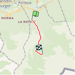
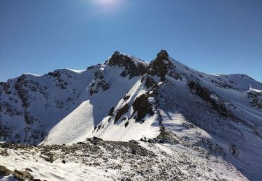
Trail Walking of 4.1 km to be discovered at Auvergne-Rhône-Alpes, Savoy, Avrieux. This trail is proposed by tracegps.

Description

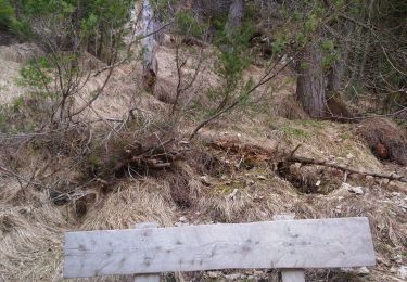
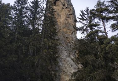
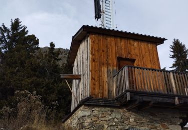
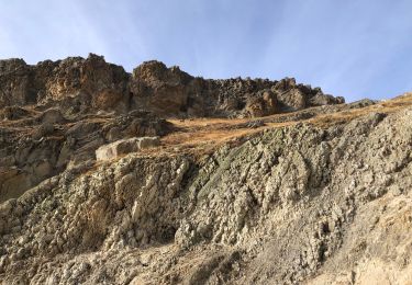
Lac de Pelouse à coté de la Norma. Pas de fléchage. Départ chapelle St Anne 1678 m.

Elevation profile

Photos

Positioning

Country:
France
Region :
Auvergne-Rhône-Alpes
Department/Province :
Savoy
Municipality :
Avrieux
Location:
Unknown
Start:(UTM)
321686 ; 5007629 (32T) N.

Comments

Please log in to post a review or rate the element


Trails nearby

Trail Running Aussois - Aussois Sardières par le Monolithe - Photo
Running
tracegps

Running

Medium
(1)
Aussois, Auvergne-Rhône-Alpes, Savoy, France
8.7 km | 12.4 km-effort
49min
Yes
Trail On foot Villarodin-Bourget - Vallon de l'Orgère - Photo
On foot
PRO

On foot

Easy
Villarodin-Bourget, Auvergne-Rhône-Alpes, Savoy, France
4 km | 5.9 km-effort
1h 19min
No
Trail Walking Aussois - cascade aussois - Photo
Walking
ermont

Walking

Medium
(1)
Aussois, Auvergne-Rhône-Alpes, Savoy, France
6.2 km | 10.9 km-effort
2h 29min
Yes
Trail Walking Aussois - Aussois barrages et pont selaria - Photo
Walking
janussity

Walking

Difficult
Aussois, Auvergne-Rhône-Alpes, Savoy, France
15.6 km | 27 km-effort
4h 46min
Yes
Trail Walking Aussois - Boucle Aussois / Monolithe / Pierre bleue / Gorges de. l'enclos - Photo
Walking
zazie

Walking

Medium
Aussois, Auvergne-Rhône-Alpes, Savoy, France
11.8 km | 20 km-effort
3h 35min
Yes
Trail Snowshoes Aussois - AUSSOIS monolithe de Sommières :aller - Photo
Snowshoes
lebarbe_b@hotmail.fr

Snowshoes

Very easy
Aussois, Auvergne-Rhône-Alpes, Savoy, France
4.5 km | 8.4 km-effort
2h 20min
No
Trail Walking Avrieux - Col du Barbier et télégraphe  - Photo
Walking
nadd73

Walking

Medium
Avrieux, Auvergne-Rhône-Alpes, Savoy, France
13.4 km | 31 km-effort
4h 37min
Yes
Trail Walking Villarodin-Bourget - Parking Orgère en direction du Col de la Masse - Photo
Walking
yves12

Walking

Medium
Villarodin-Bourget, Auvergne-Rhône-Alpes, Savoy, France
8.4 km | 18.4 km-effort
4h 18min
Yes
Trail Touring skiing Villarodin-Bourget - passage de la belle Plinier Nord - Photo
Touring skiing
nadd73

Touring skiing

Medium
Villarodin-Bourget, Auvergne-Rhône-Alpes, Savoy, France
16 km | 37 km-effort
6h 1min
Yes


Close
My subscriptions