Trail Cycle Vichy - Vichy Oleron Rochefort - Photo

Vichy Oleron Rochefort

 tracegps
tracegps

User

© OpenStreetMap contributors
Length
Length
551 km
Max alt
Max alt
730 m
Uphill gradient
Uphill gradient
6543 m
Km-Effort
Km-Effort  
639 km
Min alt
Min alt
-3 m
Downhill gradient
Downhill gradient
6797 m
Boucle
Boucle
No
Creation date :
2014-12-10 00:00:00.0
Updated on :
2014-12-10 00:00:00.0

(0 Reviews)

Cycle
Cycle
50h00
Difficulty : Medium

Scan this QR Code to open this trail in the SityTrail application

FREE GPS app for hiking

Logo SityTrail SityTrail

IGN / Geographical institutes

Download SityTrail from the App Store Download SityTrail from Google Play

Logo SityTrail SityTrail World

The world is yours!

Download SityTrail from the App Store Download SityTrail from Google Play Download SityTrail on Huawei AppGallery

About

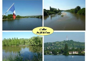
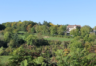
Trail Cycle of 551 km to be discovered at Auvergne-Rhône-Alpes, Allier, Vichy. This trail is proposed by tracegps.

Description

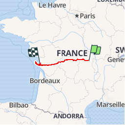
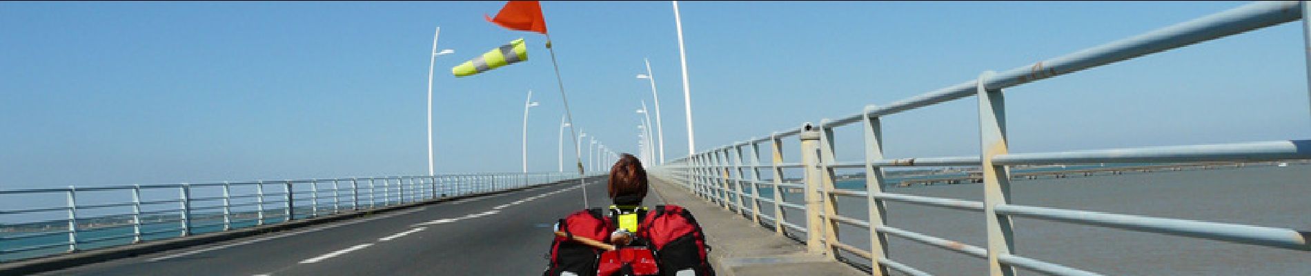
Periple en trike   chambres d'hôtes pour traverser la France et passer quelques jours sur l'ile d'Oléron

Elevation profile

Photos

Points of interest

Point of interest Crazannes - 001 - Photo
tracegps
CRAZANNES 
Point of interest Vichy - 1 bis etape Vi - Photo
tracegps
Point of interest Vichy - 1 etape Vichy - Photo
tracegps
Point of interest Buxières-sous-Montaigut - 2 etape Vichy - Photo
tracegps
BUXIÈRES-SOUS-MONTAIGUT 
Point of interest Chénérailles - 3 etape Vich 1 - Photo
tracegps
CHÉNÉRAILLES 
Point of interest Chénérailles - 3 etape Vichy - Photo
tracegps
CHÉNÉRAILLES 
Point of interest Bessines-sur-Gartempe - 4bis etape Vic - Photo
tracegps
BESSINES-SUR-GARTEMPE 
Point of interest Confolens - 5 etape Vich 1 - Photo
tracegps
CONFOLENS 
Point of interest Confolens - 5 etape Vichy - Photo
tracegps
CONFOLENS 
Point of interest Marcillac-Lanville - 6 etape Vichy - Photo
tracegps
MARCILLAC-LANVILLE 
Point of interest Plassay - 7 etape Vichy - Photo
tracegps
PLASSAY 

Positioning

Country:
France
Region :
Auvergne-Rhône-Alpes
Department/Province :
Allier
Municipality :
Vichy
Location:
Unknown
Start:(UTM)
532856 ; 5107357 (31T) N.

Trails nearby

Trail Running Bellerive-sur-Allier - jour 9 CAP Jeanot - Photo
Running
jeannat

Running

Very easy
Bellerive-sur-Allier, Auvergne-Rhône-Alpes, Allier, France
29 km | 33 km-effort
3h 5min
No
Trail Mountain bike Bellerive-sur-Allier - VTT - L'Évasion Bellerivoise - Bellerive sur Allier - Photo
Mountain bike
tracegps

Mountain bike

Difficult
Bellerive-sur-Allier, Auvergne-Rhône-Alpes, Allier, France
57 km | 67 km-effort
3h 45min
Yes
Trail Mountain bike Vichy - Rives et Boires de l'Allier - Photo
Mountain bike
tracegps

Mountain bike

Easy
(1)
Vichy, Auvergne-Rhône-Alpes, Allier, France
19.9 km | 21 km-effort
1h 45min
Yes
Trail Walking Le Vernet - Les 2 vallées: de l'Allier et du Sichon) - Photo
Walking
tracegps

Walking

Medium
(1)
Le Vernet, Auvergne-Rhône-Alpes, Allier, France
10.3 km | 13.1 km-effort
2h 30min
Yes
Trail Walking Le Vernet - Les Bois Dieux - Photo
Walking
Geronimo2010

Walking

Medium
(1)
Le Vernet, Auvergne-Rhône-Alpes, Allier, France
7.8 km | 10.7 km-effort
2h 9min
Yes
Trail Walking Vichy - Vichy - Photo
Walking
emileverschueren

Walking

Easy
Vichy, Auvergne-Rhône-Alpes, Allier, France
4 km | 4.2 km-effort
1h 58min
No
Trail Walking Le Vernet - Le Vernet - Photo
Walking
guy63

Walking

Medium
Le Vernet, Auvergne-Rhône-Alpes, Allier, France
7.2 km | 10.1 km-effort
2h 23min
Yes
Trail Walking Vichy - Vichy - Photo
Walking
guy63

Walking

Medium
Vichy, Auvergne-Rhône-Alpes, Allier, France
8.5 km | 9.2 km-effort
3h 40min
Yes
Trail Walking Vichy - vichy Historique  - Photo
Walking
guy63

Walking

Very easy
Vichy, Auvergne-Rhône-Alpes, Allier, France
7.7 km | 8.6 km-effort
2h 42min
Yes


Close
My subscriptions