


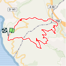

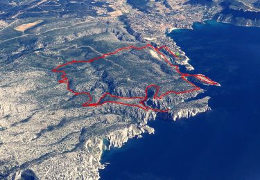
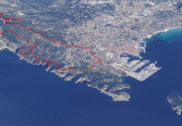
21 km | 26 km-effort

User


FREE GPS app for hiking
 SityTrail
IGN / Geographical institutes
SityTrail World
The world is yours!
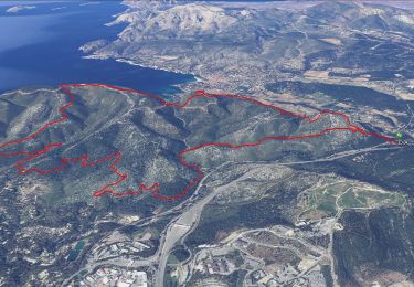
Trail Walking of 11.1 km to be discovered at Provence-Alpes-Côte d'Azur, Bouches-du-Rhône, Cassis. This trail is proposed by tracegps.
Belles vues sur La Ciotat, la Corniche des crêtes. Peu difficile niveau 3. D’autres informations sur le site de Rando Loisirs à Carnoux en Provence.

Road bike
Walking
Walking
Walking
Walking

Walking

Walking
Walking

Walking