Trail Walking Saint-Étienne-de-Tinée - Circuit Lac de Vens-Refuge et lac de Rabuons-Mont Ténibre.  - Photo

Circuit Lac de Vens-Refuge et lac de Rabuons-Mont Ténibre.

© OpenStreetMap contributors
Length
Length
31 km
Max alt
Max alt
3009 m
Uphill gradient
Uphill gradient
2481 m
Km-Effort
Km-Effort  
66 km
Min alt
Min alt
1143 m
Downhill gradient
Downhill gradient
2995 m
Boucle
Boucle
No
Creation date :
2019-01-15 16:11:33.972
Updated on :
2019-01-15 16:11:33.972

(0 Reviews)

Walking
Walking
7h44
Difficulty : Difficult

Scan this QR Code to open this trail in the SityTrail application

FREE GPS app for hiking

Logo SityTrail SityTrail

IGN / Geographical institutes

Download SityTrail from the App Store Download SityTrail from Google Play

Logo SityTrail SityTrail World

The world is yours!

Download SityTrail from the App Store Download SityTrail from Google Play Download SityTrail on Huawei AppGallery

About

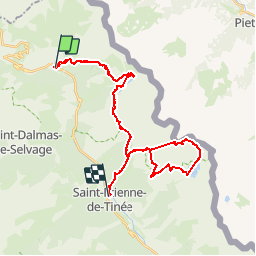
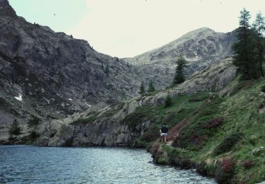
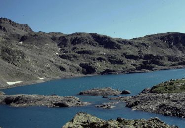
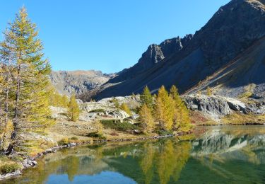
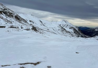
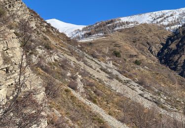
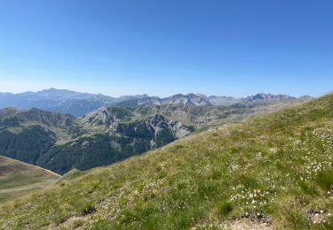
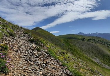
Trail Walking of 31 km to be discovered at Provence-Alpes-Côte d'Azur, Maritime Alps, Saint-Étienne-de-Tinée. This trail is proposed by Dervalmarc.

Description

Longue randonnée sur deux jours. 1300m de dénivelé. 44km de traversée.

Elevation profile

Photos

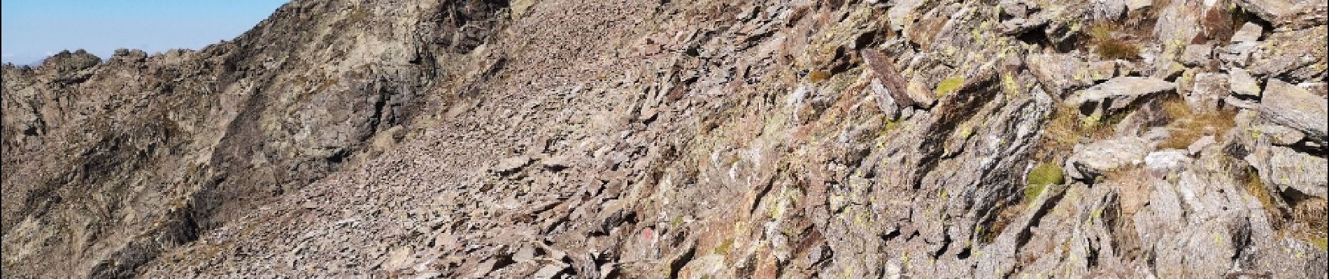
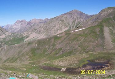
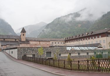
41 photos in total. Please click on a photo to see them all in the gallery.

Points of interest

Point of interest Saint-Étienne-de-Tinée - Point 25 - Photo
Dervalmarc
SAINT-ÉTIENNE-DE-TINÉE 
Point of interest Saint-Étienne-de-Tinée - Point 42 - Photo
Dervalmarc
SAINT-ÉTIENNE-DE-TINÉE 

Positioning

Country:
France
Region :
Provence-Alpes-Côte d'Azur
Department/Province :
Maritime Alps
Municipality :
Saint-Étienne-de-Tinée
Location:
Unknown
Start:(UTM)
331538 ; 4909770 (32T) N.

Trails nearby

Trail On foot Saint-Dalmas-le-Selvage - Crête de la Blanche - Photo
On foot
PRO

On foot

Medium
Saint-Dalmas-le-Selvage, Provence-Alpes-Côte d'Azur, Maritime Alps, France
12 km | 20 km-effort
4h 33min
Yes
Trail On foot Saint-Étienne-de-Tinée - Chemin de l'Energie - Photo
On foot
PRO

On foot

Very difficult
Saint-Étienne-de-Tinée, Provence-Alpes-Côte d'Azur, Maritime Alps, France
30 km | 55 km-effort
12h 34min
No
Trail On foot Saint-Étienne-de-Tinée - Chemin de l'Energie - Etape 1 - Photo
On foot
PRO

On foot

Easy
Saint-Étienne-de-Tinée, Provence-Alpes-Côte d'Azur, Maritime Alps, France
7.4 km | 16.4 km-effort
3h 44min
No
Trail On foot Saint-Étienne-de-Tinée - Chemin de l'Energie - Etape 2 - Photo
On foot
PRO

On foot

Medium
Saint-Étienne-de-Tinée, Provence-Alpes-Côte d'Azur, Maritime Alps, France
13.8 km | 24 km-effort
5h 33min
No
Trail Walking Saint-Étienne-de-Tinée - Lac de Vens - Refuge pas de Vens 11/10/19 - Photo
Walking
GUIDE
R@ph

Walking

Very difficult
Saint-Étienne-de-Tinée, Provence-Alpes-Côte d'Azur, Maritime Alps, France
19.3 km | 37 km-effort
7h 20min
Yes
Trail Snowshoes Saint-Dalmas-le-Selvage - Col de la Moutière - Photo
Snowshoes
bozo1970

Snowshoes

Medium
Saint-Dalmas-le-Selvage, Provence-Alpes-Côte d'Azur, Maritime Alps, France
17.8 km | 30 km-effort
5h 3min
Yes
Trail Snowshoes Saint-Dalmas-le-Selvage - Tête de Vinaigre  - Photo
Snowshoes
bozo1970

Snowshoes

Medium
Saint-Dalmas-le-Selvage, Provence-Alpes-Côte d'Azur, Maritime Alps, France
10.5 km | 22 km-effort
4h 22min
Yes
Trail Walking Saint-Dalmas-le-Selvage - Le Castel de la Tour - Photo
Walking
bozo1970

Walking

Very difficult
Saint-Dalmas-le-Selvage, Provence-Alpes-Côte d'Azur, Maritime Alps, France
10.5 km | 23 km-effort
5h 38min
Yes
Trail Walking Saint-Dalmas-le-Selvage - Crête de la Blanche - Photo
Walking
GuyVachet

Walking

Very difficult
Saint-Dalmas-le-Selvage, Provence-Alpes-Côte d'Azur, Maritime Alps, France
18.2 km | 30 km-effort
7h 21min
Yes


Close
My subscriptions