


Argelès-Le Racou - Collioure - 14km 262m 4h07 (40mn) - 2018 09 02

Orcal37
User GUIDE
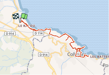

Length
14 km

Max alt
65 m

Uphill gradient
259 m
Km-Effort
17.5 km

Min alt
-1 m

Downhill gradient
258 m
Boucle
Yes
Creation date :
2019-01-15 16:27:12.921
Updated on :
2020-01-30 19:33:29.371
4h05
Difficulty : Easy

FREE GPS app for hiking
 SityTrail
IGN / Geographical institutes
SityTrail Plus
The world is yours!
About
Trail Walking of 14 km to be discovered at Occitania, Pyrénées-Orientales, Argelès-sur-Mer. This trail is proposed by Orcal37.
Description
Argelès-Le Racou - Collioure - 14km 262m 4h07 (40mn) - 2018 09 02
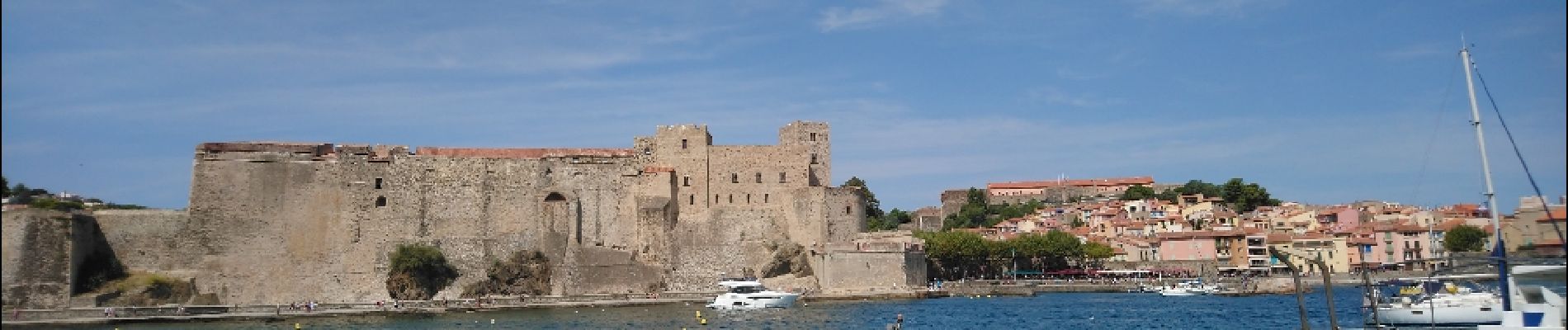
Photos
 - 2018 09 02 - Photo 1")
 - 2018 09 02 - Photo 2")
 - 2018 09 02 - Photo 3")
 - 2018 09 02 - Photo 4")
 - 2018 09 02 - Photo 5")
 - 2018 09 02 - Photo 6")
 - 2018 09 02 - Photo 7")
 - 2018 09 02 - Photo 8")
 - 2018 09 02 - Photo 9")
 - 2018 09 02 - Photo 10")
 - 2018 09 02 - Photo 11")
 - 2018 09 02 - Photo 12")
 - 2018 09 02 - Photo 13")
 - 2018 09 02 - Photo 14")
 - 2018 09 02 - Photo 15")
 - 2018 09 02 - Photo 16")
 - 2018 09 02 - Photo 17")
 - 2018 09 02 - Photo 18")
 - 2018 09 02 - Photo 19")
 - 2018 09 02 - Photo 20")
 - 2018 09 02 - Photo 21")
21 photos in total. Please click on a photo to see them all in the gallery.
Positioning
Country:
France
Region :
Occitania
Department/Province :
Pyrénées-Orientales
Municipality :
Argelès-sur-Mer
Location:
Unknown
Start:(Dec)
Start:(UTM)
504180 ; 4709554 (31T) N.
Comments