Trail Mountain bike Bussang - VTT autour de Bussang - Photo

VTT autour de Bussang

 pascalou73
pascalou73

User GUIDE

© OpenStreetMap contributors
Length
Length
27 km
Max alt
Max alt
981 m
Uphill gradient
Uphill gradient
631 m
Km-Effort
Km-Effort  
36 km
Min alt
Min alt
550 m
Downhill gradient
Downhill gradient
631 m
Boucle
Boucle
Yes
Creation date :
2019-01-15 17:13:25.679
Updated on :
2019-01-15 17:13:25.679

(0 Reviews)

Mountain bike
Mountain bike
2h19
Difficulty : Medium

Scan this QR Code to open this trail in the SityTrail application

FREE GPS app for hiking

Logo SityTrail SityTrail

IGN / Geographical institutes

Download SityTrail from the App Store Download SityTrail from Google Play

Logo SityTrail SityTrail World

The world is yours!

Download SityTrail from the App Store Download SityTrail from Google Play Download SityTrail on Huawei AppGallery

About

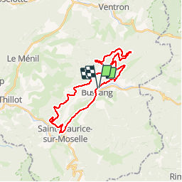
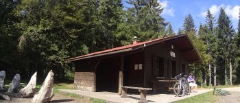
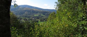
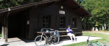
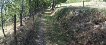
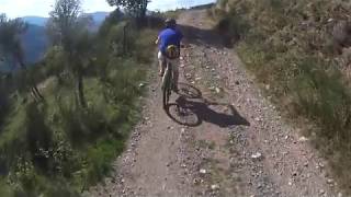
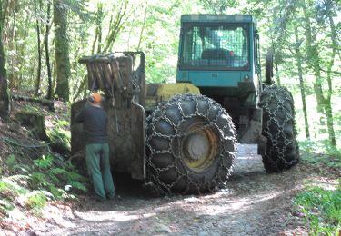
Trail Mountain bike of 27 km to be discovered at Grand Est, Vosges, Bussang. This trail is proposed by pascalou73.

Description

Voilà un VTT au départ du village de Bussang dans les Vosges .au départ du circuit une belle côte .La randonnée va passe par plusieurs sieurs circuit de la région le N°6 -8-7 avec le retour par l'abri du vallon la fin par la voie verte .

Elevation profile

Photos

Points of interest

Point of interest Fresse-sur-Moselle - vtt bussang - Photo
pascalou73
FRESSE-SUR-MOSELLE 
Point of interest Bussang - vtt bussang - Photo
pascalou73
BUSSANG 
Point of interest Bussang - vtt bussang - Photo
pascalou73
BUSSANG 
Point of interest Bussang - vtt bussang - Photo
pascalou73
BUSSANG 
Point of interest Bussang - vtt bussang - Photo
pascalou73
BUSSANG 

Positioning

Country:
France
Region :
Grand Est
Department/Province :
Vosges
Municipality :
Bussang
Location:
Unknown
Start:(UTM)
339837 ; 5306181 (32T) N.

Trails nearby

Trail Walking Bussang - Col de Bussang - Rouge Gazon - Séchenat - Photo
Walking
VacheKiri67

Walking

Difficult
(1)
Bussang, Grand Est, Vosges, France
15 km | 24 km-effort
6h 0min
No
Trail Snowshoes Bussang - Circuit de raquette de Bussang - Photo
Snowshoes
tracegps

Snowshoes

Difficult
(1)
Bussang, Grand Est, Vosges, France
7.7 km | 11.2 km-effort
3h 0min
Yes
Trail Walking Storckensohn - lac des perches marchettes - Photo
Walking
lacote

Walking

Medium
(1)
Storckensohn, Grand Est, Haut-Rhin, France
11.9 km | 20 km-effort
4h 8min
Yes
Trail Walking Fellering - Felsach _chapelle ST Nicolas_frenz - Photo
Walking
Le grand Claude

Walking

Difficult
(1)
Fellering, Grand Est, Haut-Rhin, France
9.6 km | 16.5 km-effort
3h 45min
Yes
Trail Mountain bike Saint-Maurice-sur-Moselle - SityTrail - 3248441 - documentxix745004916x3256137 - Photo
Mountain bike
GUIDE
pascalou73

Mountain bike

Medium
Saint-Maurice-sur-Moselle, Grand Est, Vosges, France
21 km | 30 km-effort
2h 3min
Yes
Trail Mountain bike Bussang - activity_9407679223 - Photo
Mountain bike
GUIDE
pascalou73

Mountain bike

Medium
Bussang, Grand Est, Vosges, France
21 km | 30 km-effort
2h 2min
Yes
Trail Walking Ventron - 2022-02-19 Marche Ventron Tête des Champs - Photo
Walking
GUIDE
holtzv

Walking

Very difficult
Ventron, Grand Est, Vosges, France
22 km | 34 km-effort
5h 52min
Yes
Trail On foot Ventron - Circuit de la Croix de l’Hermite par Forgoutte - Photo
On foot
PRO

On foot

Easy
Ventron, Grand Est, Vosges, France
4.3 km | 6.6 km-effort
1h 29min
No
Trail On foot Ventron - Circuit panoramique de la Futaie - Photo
On foot
PRO

On foot

Easy
Ventron, Grand Est, Vosges, France
8.8 km | 12.6 km-effort
2h 52min
Yes


Close
My subscriptions