Trail Walking Bonsecours - Chemin du Mont Saint Michel - Photo

Chemin du Mont Saint Michel

LOIN ET LÉGER

© OpenStreetMap contributors
Length
Length
346 km
Max alt
Max alt
352 m
Uphill gradient
Uphill gradient
5489 m
Km-Effort
Km-Effort  
419 km
Min alt
Min alt
-1 m
Downhill gradient
Downhill gradient
5495 m
Boucle
Boucle
No
Creation date :
2019-01-15 17:29:50.149
Updated on :
2019-06-26 11:58:16.628

(0 Reviews)

Walking
Walking
6h06
Difficulty : Medium

Scan this QR Code to open this trail in the SityTrail application

FREE GPS app for hiking

Logo SityTrail SityTrail

IGN / Geographical institutes

Download SityTrail from the App Store Download SityTrail from Google Play

Logo SityTrail SityTrail World

The world is yours!

Download SityTrail from the App Store Download SityTrail from Google Play Download SityTrail on Huawei AppGallery

About

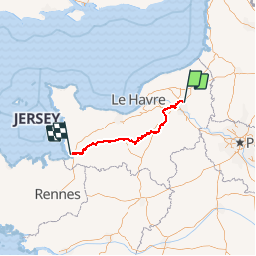
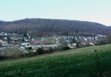
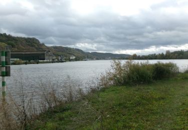
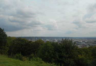
Trail Walking of 346 km to be discovered at Normandy, Seine-Maritime, Bonsecours. This trail is proposed by ULTR@ TREK.

Description

ULTR@ TREK
De Rouen au Mont St Michel
Une immersion en pays Normand .
Chemin plutôt facile qui est a mon avis pour de la rando itinérante de gite en gite. Pas mal de goudron et pas toujours simple pour le bivouac.
fait en décembre 2018 dans des conditions d'hiver, pluie et froid.

Elevation profile

Photos

Points of interest

Point of interest Honguemare-Guenouville - Barneville-sur-Seine - Monument aux Morts - Photo
zefreefly
HONGUEMARE-GUENOUVILLE 
Point of interest Barneville-sur-Seine - Passage sur la D 91 - Photo
zefreefly
BARNEVILLE-SUR-SEINE 
Point of interest Honguemare-Guenouville - Passage sur la D 91 sous l'A 13 - Photo
zefreefly
HONGUEMARE-GUENOUVILLE 
Point of interest Bosgouet - Traversée de Bourg-Achard - Photo
zefreefly
Point of interest Illeville-sur-Montfort - Traversée de la D 88 - Photo
zefreefly
ILLEVILLE-SUR-MONTFORT 
Point of interest Appeville-Annebault - Descente de la route forestière - Photo
zefreefly
APPEVILLE-ANNEBAULT 
Point of interest Montfort-sur-Risle - Montfort-sur-Risle - Photo
zefreefly
MONTFORT-SUR-RISLE 

Positioning

Country:
France
Region :
Normandy
Department/Province :
Seine-Maritime
Municipality :
Bonsecours
Location:
Unknown
Start:(UTM)
362966 ; 5477379 (31U) N.

Trails nearby

Trail Walking Mont-Saint-Aignan - Mont-saint-aignan - Chasse-Marée -  - Photo
Walking
MichelRando7656

Walking

Difficult
(1)
Mont-Saint-Aignan, Normandy, Seine-Maritime, France
11.7 km | 15.2 km-effort
3h 27min
Yes
Trail Walking Darnétal - 076-34-le tour de Darnétal 13km 875-557 - Photo
Walking
rvs147

Walking

Medium
(1)
Darnétal, Normandy, Seine-Maritime, France
9.8 km | 13.1 km-effort
3h 32min
Yes
Trail Walking Rouen - 076-102--Bonsecours Darnetal par St Hilaire 13km- - Photo
Walking
rvs147

Walking

Medium
(1)
Rouen, Normandy, Seine-Maritime, France
13.1 km | 16 km-effort
21min
Yes
Trail Walking Saint-Étienne-du-Rouvray - Forêt St. EtienneDu Rouvray P2 (86) - Photo
Walking
randovivi

Walking

Very easy
(1)
Saint-Étienne-du-Rouvray, Normandy, Seine-Maritime, France
9.7 km | 10.7 km-effort
2h 23min
Yes
Trail Walking Darnétal - 20240108-Darnetal - Photo
Walking
doudet

Walking

Medium
Darnétal, Normandy, Seine-Maritime, France
10.1 km | 13.4 km-effort
3h 10min
Yes
Trail Walking Le Grand-Quevilly - 20231219-la su 3 cool - Photo
Walking
doudet

Walking

Easy
Le Grand-Quevilly, Normandy, Seine-Maritime, France
7.8 km | 9 km-effort
2h 8min
Yes
Trail Walking Rouen - 20231109-Rouen  - Photo
Walking
doudet

Walking

Easy
Rouen, Normandy, Seine-Maritime, France
3.2 km | 3.6 km-effort
57min
Yes
Trail Walking Déville-lès-Rouen - 20230829-Déville les Rouen - Photo
Walking
doudet

Walking

Medium
Déville-lès-Rouen, Normandy, Seine-Maritime, France
11.9 km | 16.3 km-effort
3h 38min
Yes
Trail Walking Le Grand-Quevilly - 20230523-Quevilly Cool - Photo
Walking
doudet

Walking

Easy
Le Grand-Quevilly, Normandy, Seine-Maritime, France
7.8 km | 9 km-effort
2h 17min
Yes


Close
My subscriptions