Trail Mountain bike Guebwiller - Espace VTT - FFC Région de Guebwiller - n°02 - Circuit du Rosstall  - Photo

Espace VTT - FFC Région de Guebwiller - n°02 - Circuit du Rosstall

 tracegps
tracegps

User

© OpenStreetMap contributors
Length
Length
14.3 km
Max alt
Max alt
565 m
Uphill gradient
Uphill gradient
514 m
Km-Effort
Km-Effort  
21 km
Min alt
Min alt
325 m
Downhill gradient
Downhill gradient
511 m
Boucle
Boucle
Yes
Creation date :
2014-12-10 00:00:00.0
Updated on :
2014-12-10 00:00:00.0

(0 Reviews)

Mountain bike
Mountain bike
1h00
Difficulty : Medium

Scan this QR Code to open this trail in the SityTrail application

FREE GPS app for hiking

Logo SityTrail SityTrail

IGN / Geographical institutes

Download SityTrail from the App Store Download SityTrail from Google Play

Logo SityTrail SityTrail World

The world is yours!

Download SityTrail from the App Store Download SityTrail from Google Play Download SityTrail on Huawei AppGallery

About

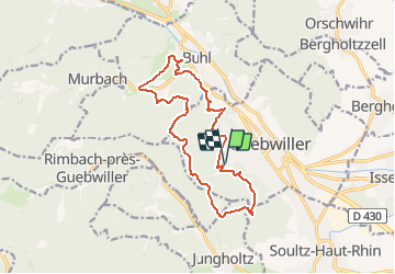
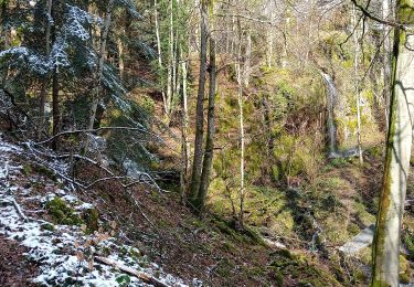
Trail Mountain bike of 14.3 km to be discovered at Grand Est, Haut-Rhin, Guebwiller. This trail is proposed by tracegps.

Description

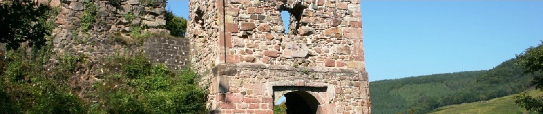
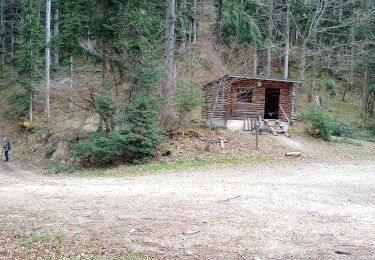
Espace VTT - FFC Région de Guebwiller - n°02 - Circuit du Rosstall Circuit officiel labellisé par la Fédération Française de Cyclisme. Au départ de la Sandgrube, par la clairière des Bruyères, le Bildstoecklé et le Peternit-Rosstall (traduction : écurie), cet itinéraire vous permettra de rejoindre le château du Hugstein en passant par le Saint-Barnabé et Buhl (avec son église et son retable). Retour par l’Ermitage et le Luspel. La partie la plus ancienne de Buhl est regroupée autour de l’église sur un promontoire qui a donné son nom au village (Bühel : la colline). L’église paroissiale Saint-Jean-Baptiste abrite, au cœur de sa nef, un retable, œuvre picturale majeure du bassin rhénan. Cette peinture précieuse de l’école de Martin Schoengauer date du XVème siècle et provient probablement de l’ancien couvent des Catherinettes de Colmar. Topo guide VTT en vente à l’Office du Tourisme de Guebwiller-Soultz et les Pays du Florival - Antenne de Guebwiller - 71 Rue de la République - 68500 – Guebwiller Tel. : 03 89 76 10 63 - Fax :03 89 76 52 72 Crédit photos ; ©Pays d’Art et d’Histoire de la Région de Guebwiller

Elevation profile

Photos

Positioning

Country:
France
Region :
Grand Est
Department/Province :
Haut-Rhin
Municipality :
Guebwiller
Location:
Unknown
Start:(UTM)
365294 ; 5307329 (32T) N.

Trails nearby

Trail Walking Soultz-Haut-Rhin - Rando Marcheurs..04/04_2025 - Photo
Walking
boubou68

Walking

Very difficult
Soultz-Haut-Rhin, Grand Est, Haut-Rhin, France
21 km | 35 km-effort
4h 42min
Yes
Trail Walking Jungholtz - Rando Retrouvailles...01/03/2024.par Jean Marc - Photo
Walking
boubou68

Walking

Very difficult
Jungholtz, Grand Est, Haut-Rhin, France
11.3 km | 19.2 km-effort
1h 35min
Yes
Trail Walking Murbach - La
Walking
boubou68

Walking

Very difficult
Murbach, Grand Est, Haut-Rhin, France
14.7 km | 28 km-effort
4h 3min
Yes
Trail Walking Murbach - Murbach - Photo
Walking
oscar1

Walking

Difficult
Murbach, Grand Est, Haut-Rhin, France
15.4 km | 25 km-effort
4h 25min
Yes
Trail Walking Soultz-Haut-Rhin - Rando avec 0mar et Mouloud..18/02/2023 - Photo
Walking
boubou68

Walking

Very difficult
Soultz-Haut-Rhin, Grand Est, Haut-Rhin, France
12 km | 20 km-effort
3h 9min
Yes
Trail Walking Orschwihr - Boucle pour Soultzmatt - Photo
Walking
GuyVachet

Walking

Medium
Orschwihr, Grand Est, Haut-Rhin, France
12.4 km | 16.5 km-effort
4h 4min
Yes
Trail Walking Soultz-Haut-Rhin - Wuenheim -  Kohlschlag  (18/03/2021) - Photo
Walking
Richard68500

Walking

Medium
Soultz-Haut-Rhin, Grand Est, Haut-Rhin, France
15.9 km | 26 km-effort
4h 8min
Yes
Trail Walking Buhl - Wolfsgrube (4/3/2021) - Photo
Walking
Richard68500

Walking

Medium
Buhl, Grand Est, Haut-Rhin, France
12 km | 19 km-effort
3h 39min
Yes
Trail Walking Guebwiller - Col du Dreibannstein (25/02/2021) - Photo
Walking
Richard68500

Walking

Medium
Guebwiller, Grand Est, Haut-Rhin, France
12 km | 17.5 km-effort
3h 42min
Yes


Close
My subscriptions